
Today:
Expect much of the same conditions from yesterday, but maybe lose the winter coat as temperatures will reach the low 60s by midday. We can expect the second half of a the low pressure system to pass through our area, bringing light to moderate rain, during the morning and then giving way to cloudy and humid conditions by early afternoon. Winds will be light and variable out of the southwest.
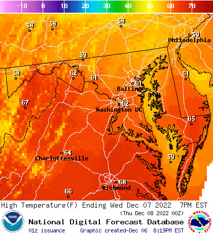
Regional high Temperatures for Wednesday. (Image via NWS)
Tonight:
As we move into the evening, cloudy conditions will shift to mostly cloudy and temperatures will drop into the mid 40s. This will mark the beginning of a short period of dry conditions until another low pressure system rides through the Mid Atlantic by the week’s end. Prepare your night accordingly for a light fog that will cloak the region until the early morning hours on Thursday.
Tomorrow (Thursday):
On Thursday, we will see a quick break in precipitation with partly cloudy conditions for most of the morning and afternoon. Highs should reach the mid 50s by 2 p.m. We can expect a slight increase in wind gusts from 5-10 m.p.h. out of the North, but nothing to lose your hat from. Partly cloudy skies during the day will give rise to overcast by evening with temperatures dropping quickly after sunset. Another round of low pressure will sneak into the College Park area late Thursday into Friday giving us a wet end to the week.
A Look Ahead:
Models are pointing to a third wave of precipitation to reach our area by Sunday after a cool and cloudy Saturday. We will finally see a break in precipitation early next week and can expect temperatures to return to the seasonal averages with highs in the low 50s and lows in the mid 30s.