
After a beautiful weekend, we were treated to an equally lovely Monday morning here in College Park. We saw plenty of sunshine during the day which, along with our southeasterly wind, helped to bring us mild springtime temperatures. Our high maxed out at a seasonable 69°F. However, such beautiful conditions can’t last forever. Today’s abundant sunshine has begun to give way to clouds this afternoon ahead of our next weather-maker.
Through Tonight
Clouds will continue to increase and thicken throughout the night. They will help keep our temperatures from dropping off rapidly. Overnight lows are expected to linger in the mid 40’s for most of the region. Our winds will remain out of the southeast, but the stronger gusts should subside. Suburbs located to the south of DC will have an increased chance of showers tonight as a low-pressure system approaches the region.
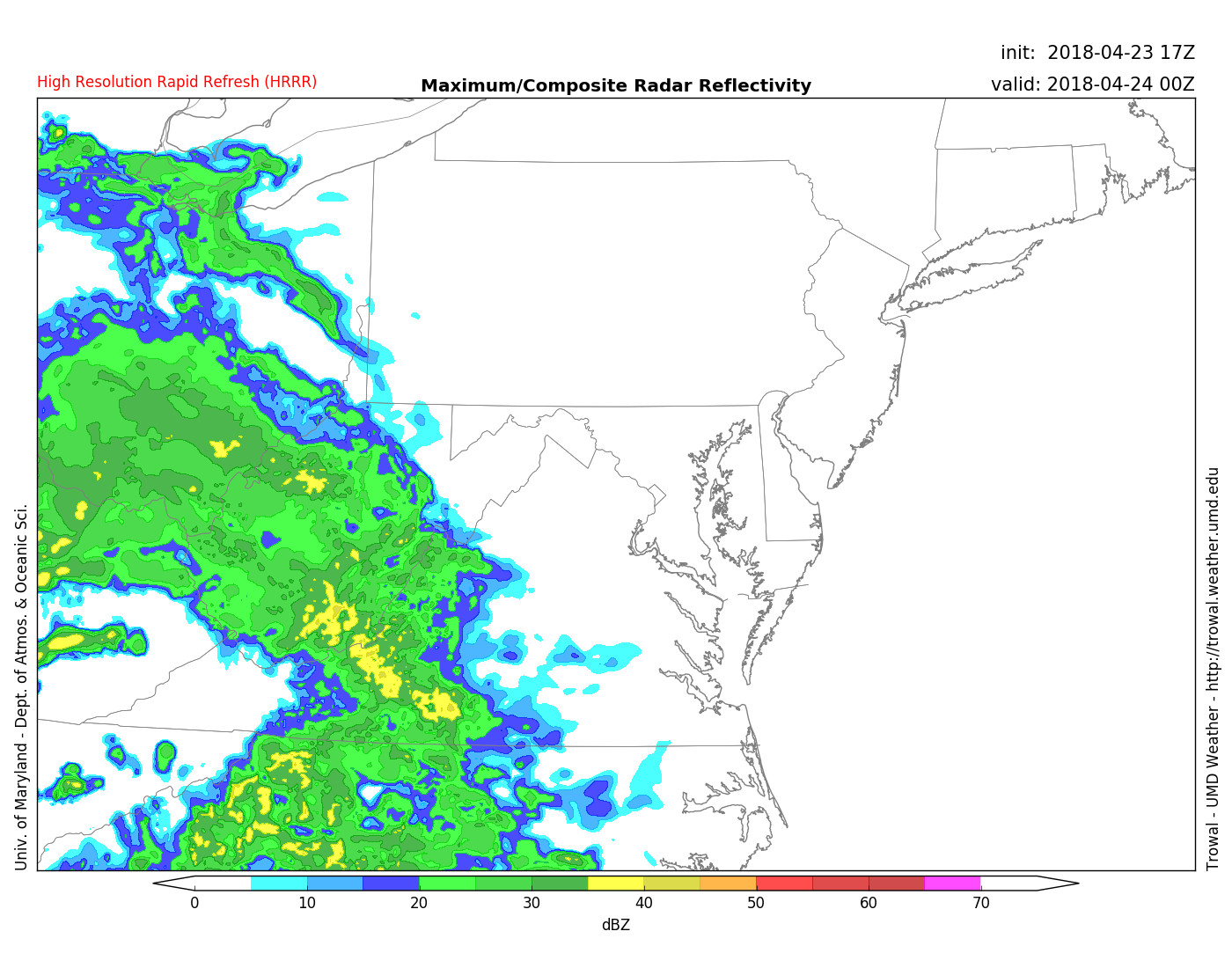
Model output forecasting rain showers at 8 PM Monday night. (Source: UMD Trowal)
Tomorrow (Tuesday)
Tuesday will be a sharp contrast to the delightful weather we’ve seen in the last few days. A large low-pressure system will be moving in during the early hours on Tuesday. Tuesday’s highs will stay in the upper 50’s with the cloudy skies and rainy weather. The rain should begin by the start of the morning rush, making for a potentially messy commute. But, the heaviest showers should hold off until the afternoon. Most of the region is likely to see more than an inch of rain through Wednesday. Winds will be out of the east at 10-15 mph, gusting to 20 mph.
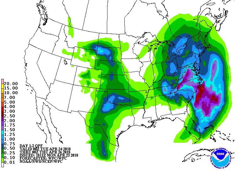
A quantitative precipitation forecast predicting more than an inch of rain for most of the DMV (Source: Weather Prediction Center)