
The Storm Prediction Center issued an “Enhanced Risk” for severe weather today, as conditions were favorable for an incoming storm system to bring damaging winds, heavy rain, and small hail, as well as a small risk for an isolated tornado. This morning’s clouds gave way to some sun by midday, allowing the temperature in College Park to peak at 75F before the storms moved through. This daytime heating provided some fuel for a fast-moving line of thunderstorms that passed through the area from 1-3 PM. The storm’s damaging winds brought down some trees and power lines, causing some power outages across the DC Metro Area, but College Park was left largely unscathed.
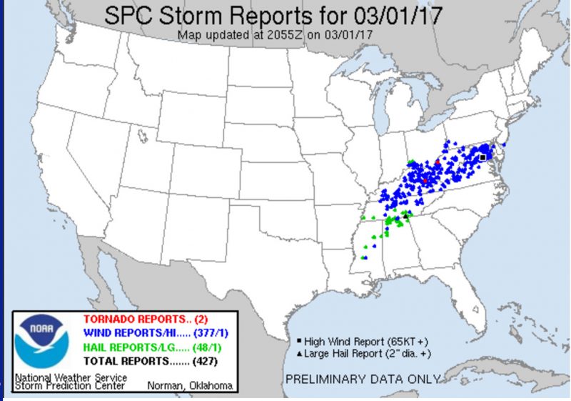
Storm reports 3/1/17 (Source: Storm Prediction Center)
Through Tonight
A lingering chance for showers and thunderstorms continues into the evening hours as today’s storm system pushes out of the area. These showers should give way to partly cloudy conditions overnight. Behind the system, temperatures should fall overnight into the 40’s, bringing an end to our streak of unseasonable warmth. A wind advisory has been issued for the area from 10 pm tonight through 10 am tomorrow. Winds will shift from the southwest to out of west-northwest at 20-30 mph, gusting up to 45 mph as the front pushes through.
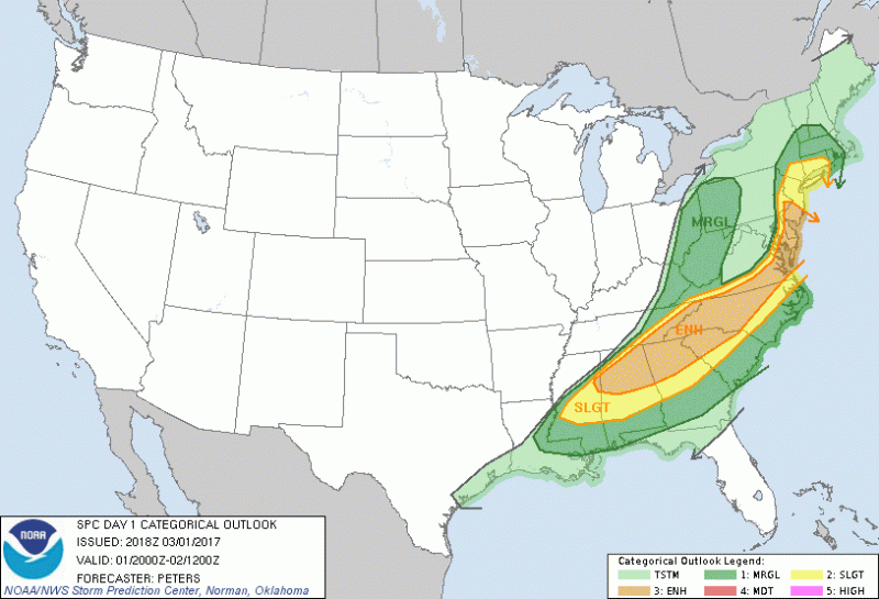
The severe weather threat for the immediate DC Metro has been downgraded from Enhanced to just the possibility of thunderstorms as of 4PM (Source: Storm Prediction Center)
Tomorrow (Thursday)
Tomorrow morning’s commute will see a return to seasonable temperatures with partly to mostly sunny skies. Bring out your coasts again as early morning temperatures will be in the low to mid 30’s. Tomorrow’s highs will barely reach the low 50’s, but the winds will make it seem colder, with sustained winds of 10-20mph. Some gusts may exceed 30mph throughout the day.
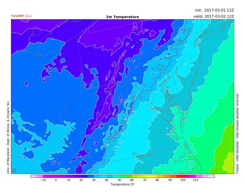
Morning temperatures in the 30’s and 40’s across the area around 7AM Thursday Morning (Source: UMD Trowal)