
Happy March and meteorological Spring! What better way to ring in the month. The storm system that brought hail, tornadoes, and severe winds to the midwest has made its way east and will affect the local area this afternoon. The NWS has issued a Severe Thunderstorm Watch for all of Central and Western Maryland. This means that conditions are favorable for severe weather to occur.
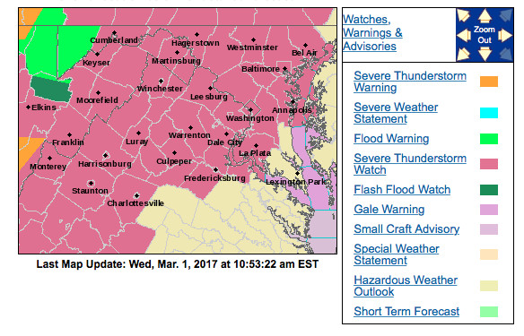
The pink color denotes a Severe Thunderstorm Watch over the area. (Via NWS)
Timing:
A line of storms will track east and move into the region between 1 and 3 p.m. The storms will move through fast however, so expect a quick hard hitting storm to pass through. Make sure you check the current conditions before venturing outside as conditions will change very rapidly. There is also another chance of some rain and isolated thunderstorms this evening for the late commute.
Impacts:
The main threat will be winds. The SPC has put College Park in a 45% chance of damaging winds that could break down tree limbs and cause isolated power outages. Small hail (up to 1.50 inches in diameter) is also possible and an isolated tornado within the squall line cannot be 100% ruled out.
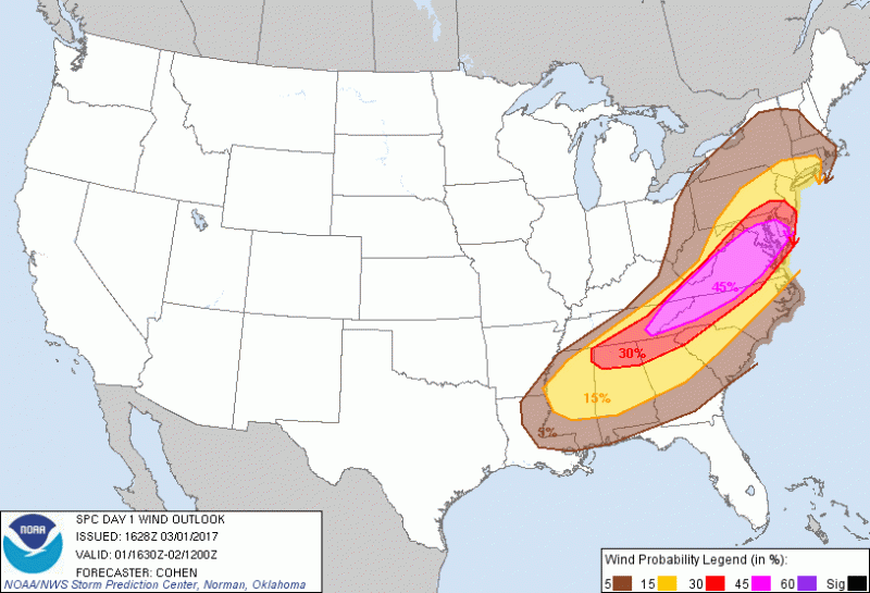
The Storm Prediction Center has the College Park area in 45% chance of damaging winds.
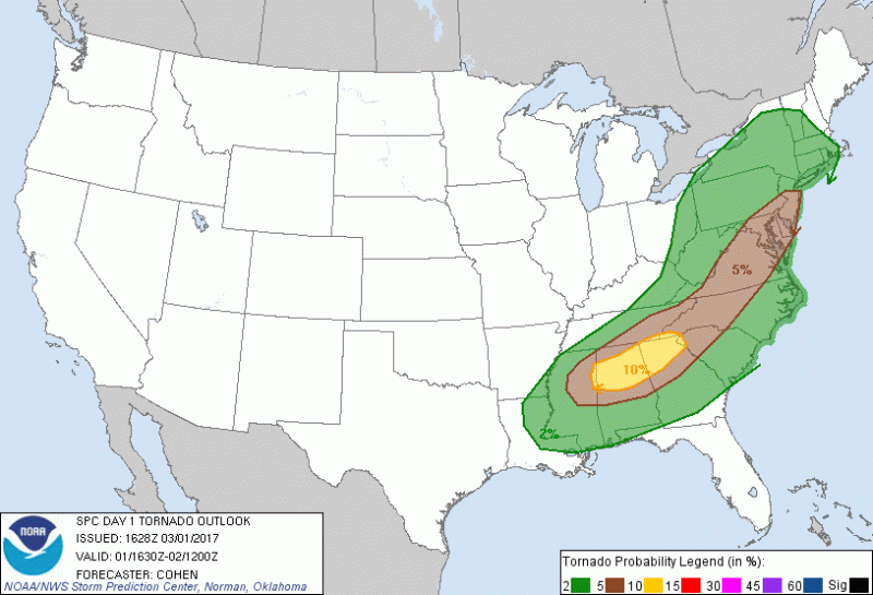
SPC has the College Park area in a high 5% chance of a Tornado.
One of the things to watch over the next few hours would be to see if the sun can break through the clouds and cause more instability. As temperatures increase the threat for severe weather will also increase. The longer the clouds hold on, the least likely severe weather will develop.
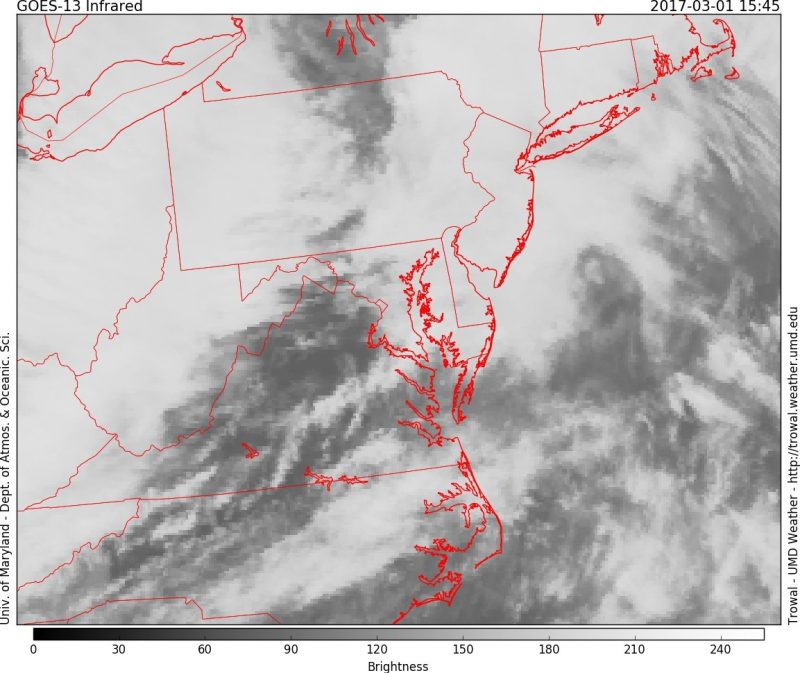
Visible satellite shows some clearing in Virginia. (Via Trowal)
Follow UMD Weather on Facebook and @UMD_weather on Twitter for constant updates!