
Good Morning, Terps! After seeing a lot of hype surrounding the upcoming winter storm, we decided to create a final updated forecast in hopes to provide clear and concise information about what we can expect on campus this weekend.
**Winter Storm Update**:
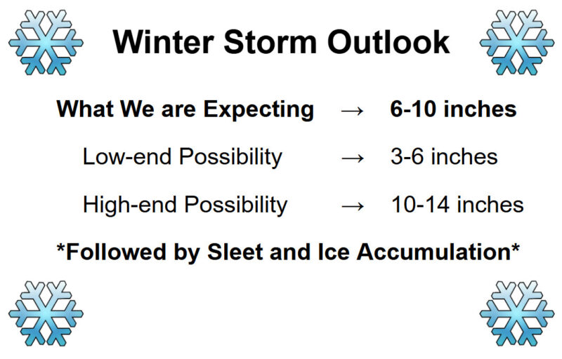
We understand that several weather apps still have snowfall totals nearing two feet as of Friday night. The reason for this is that these apps tend to output raw computer model data, which most likely does not account for model consistency, trends, and sleet/ice mixing which will cut down on the snow totals. However, although two feet of snow appears unlikely, College Park will still experience a significant storm. Below is our final snowfall forecast:
Timing:
Light snow showers are expected to enter the area just before midnight on Saturday. As it currently stands, any move-in activities during the day on Saturday should remain uninterrupted by adverse weather. After midnight, snow will gradually become heavier, with the majority of snow accumulation occurring between 2:00 and 10:00 am on Sunday. Below is what the radar could look like around sunrise.
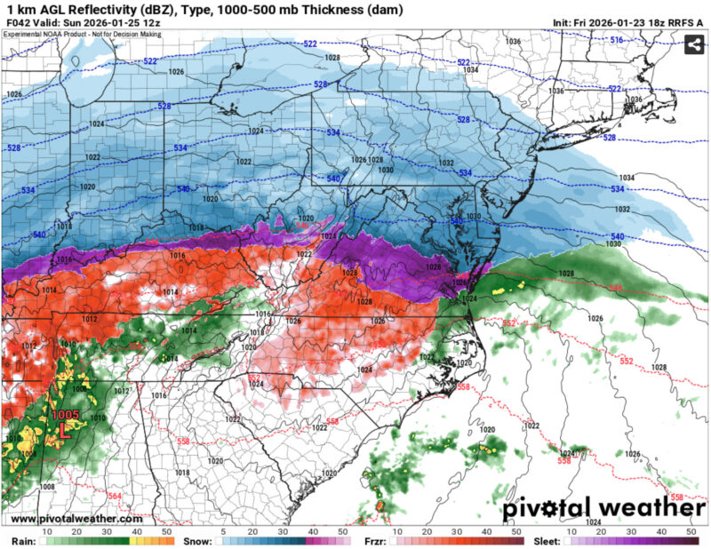
Via www.pivotalweather.com
Snow is then expected to phase into sleet during the late morning to early afternoon hours, and eventually to freezing rain during the late afternoon to evening hours on Sunday. Significant sleet and ice accumulation is possible. It is important to note that the timing of the transition between snow and sleet/ice will greatly impact total snowfall accumulation. Pictured below is what the radar could look like closer to sunset, with the orange colors representing freezing rain.
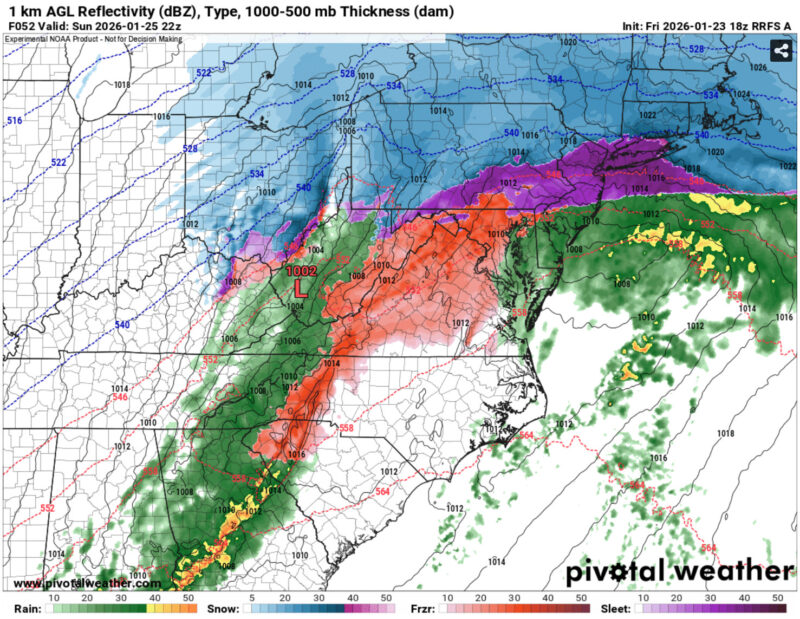
Via www.pivotalweather.com
Important Reminders:
Although this event is unlikely to produce historic snowfall totals of several feet, we are still expecting a high-impact winter storm that could pose significant risks to life and property across the region, as worded by our local NWS office. If the freezing rain threat continues to uptrend, icing could lead to treacherous roadway conditions and possible power outages, which would only be made worse by the frigid temperatures. Starting on Saturday, wind chill values near or below zero are possible for several days, and temperatures will struggle to reach above freezing for at least a week.
That’s all for now, Terps. Continue to check our local NWS office for official warnings, and visit umd.edu/weather for updates on campus closures and services. Stay safe commuting to campus, and enjoy the snow!
Author: Donovan Fry
Editor: Anjali Vidyasagar