
It’s time to dig out those jackets and hats again! The first taste of winter-like weather will hit College Park early this week. Expect daytime temperatures in the upper 40s and lower 50s and nighttime temperatures near-freezing for the first half of this week before a period of warmer temperatures, starting on Wednesday.
Today:
College Park is in for its first cold spell of the semester! Conditions today will be breezy and chilly with clear skies. Expect temperatures to range in the 40s throughout the daytime, with high temperatures around noon in the upper 40s. Winds remain around 15 mph throughout most of the day, with gusts in the 20 to 25 mph range possible. With the chillier temperatures and breezy conditions, expect to feel deceivingly cold; be sure to pack a jacket on the way to classes today!
Tonight:
Temperatures fall into the 30s in the late evening, and winds linger around 10 mph. Gusts are expected to remain around 20 mph. Without the sun, temperatures could feel very cold, so be sure to bundle up if you plan to be outside after sunset.
Tomorrow (Tuesday):
The chilly and windy weather continues into Tuesday. Expect clear skies with some scattered clouds. Winds are expected in the 15 to 20 mph range, with gusts possible up to 30 mph. Temperatures at sunrise start in the upper 20s to lower 30s before reaching a daytime high temperature in the mid-40s. Similar to Monday, the chilly temperatures and strong breezes will make the air deceivingly cold. Make sure to bundle up if you plan on being outside!
Looking Ahead:
After the chilly weather on Monday and Tuesday, temperatures will return to what we’ve been experiencing so far in November. We return to a pattern of daytime temperatures in the mid-50s and low 60s and nighttime temperatures in the upper 30s to low 40s. Daytime breezes in the 10 to 15 mph range should stick around until Friday.
Discussion:
The East Coast is up for a major cold spell! Unfortunately, our area will miss many of the exciting events that the rest of the East Coast will be experiencing. In general, a strong cold front that passed through the area Sunday night is responsible for the chilly weather during the first half of this week.
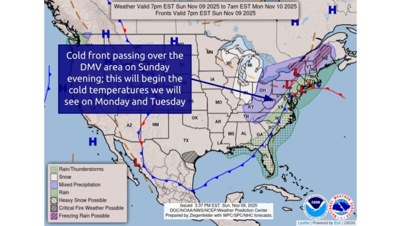
Via https://www.wpc.ncep.noaa.gov/NationalForecastChart/staticmaps/
Regarding the general large-scale patterns affecting the East Coast, the primary cause of the colder weather we’ll be seeing is due to the polar jet dipping down into the United States. This will bring lots of cold air, which will foster the development of a deep upper-level trough.
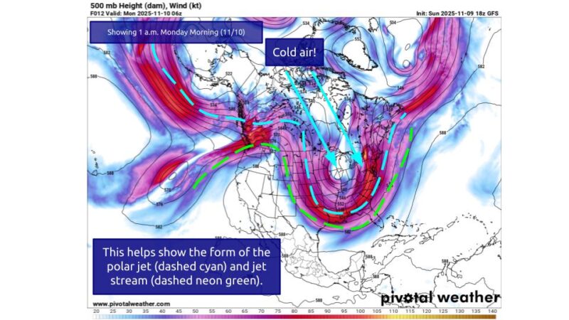
Via www.pivotalweather.com
Via www.pivotalweather.com
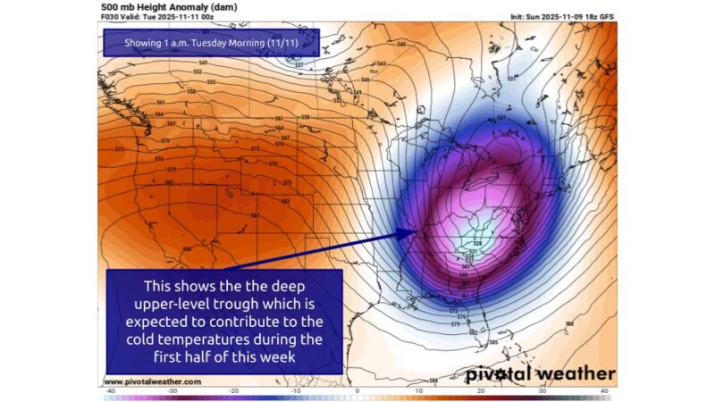
Additionally, the surface pressure setup will bring in a lot of interesting patterns, particularly contributing to the steep pressure gradients and the shape of our jet stream.
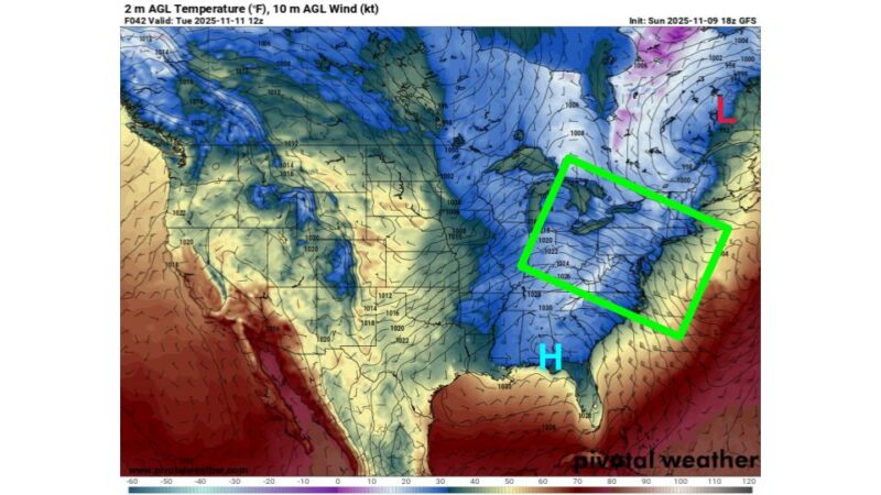
Taking a look at the Tuesday 00z (Monday evening) upper-level pattern, we can see the position of the surface low to the northeast and the development of a surface high in the southwest. This setup will not only help drag cold air down into the East Coast, but it will also help set up a steep pressure gradient for the East Coast, which will contribute to the high winds we’ll see for the week.
Via www.pivotalweather.com
As we transition out of this pattern (i.e., once this trough moves out into the Atlantic), the high pressure to the south of our area will send up some warmer air, which will end this period of cold. Additionally, the high pressure will also help keep our skies clear. With this, we’ll return to the mild temperatures and clear skies we’ve been seeing for most of November. This pattern will develop on Wednesday and persist until the end of the workweek.
Also, I (the writer of this forecast discussion) know that there’s been some talk regarding the probability of snowfall for today and tomorrow. The chances of snowfall are unlikely for the College Park area.
Most snow that would happen near us is primarily limited to the mountains, where lifting conditions help with the development of some wintry precipitation. Unfortunately, these atmospheric conditions are not present in our area, and the air does not look like it will have enough moisture to result in any significant snowfall or flurries.
Regardless, stay warm and good luck with this upcoming week!
- Writer: Frances Schoenly
- Editor: Donovan Fry
Featured image via Frances Schoenly