Today:
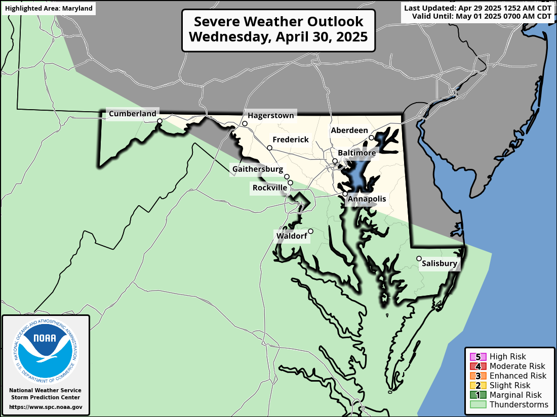
A quick-moving low pressure will drop down from the Great Lakes Thursday night into Friday. The cold front associated with this system may spark some scattered showers and thunderstorms throughout the region, especially during the afternoon and evening, so it’s not unwise to carry some rain gear and an umbrella if you’re out and about. Some of these storms could be strong to severe as indicated by the Storm Prediction Center graphic below, with strong winds and hail being the main threats in any stronger storm cells. Afternoon high temperatures will rise into the 70s and 80s along the I-95 corridor, with cooler conditions as you head towards the mountains. Dewpoints along the I-95 corridor will also rise into the 60s, so it’ll feel a little humid ahead of the front. Winds will range between 5-15 mph out of the northwest as our system moves off to our northeast.

Image showing the Storm Prediction Center’s severe weather risk map for Friday. Much of central Maryland in a marginal risk and areas east of the I-95 corridor in a slight risk (Image via NWS Storm Prediction Center).

National surface front & precipitation map, showing rain/thunderstorm activity in Maryland ahead of an approaching cold front (Image via NWS Weather Prediction Center).
Tonight:
The aforementioned cold front will move through the region, ending any precipitation chances overnight and dropping temperatures into the 40s in the mountains and 50s from the Piedmont to the coastal plain. Winds will continue to be out of the west-northwest at around 5-15 mph.
Tomorrow (Saturday):
The weekend will start off fairly dry as we temporarily sit between high pressure to our northwest and an upper level low pressure to our northeast. A few showers are possible, but it should be mostly dry with sunny/mostly sunny skies. Afternoon high temperatures will once again get into the 70s and 80s along the I-95 corridor. It should be a great day for outdoor activities and events! Winds will remain out of the northwest at 10-15 mph, with gusts up to 25-30 mph.
Tomorrow Night (Saturday Night):
Conditions will stay dry and clear. Low temperatures will be similar to those of Friday night – 40s in the mountains and 50s from the Piedmont to the coastal plain. Winds will be calm and variable.
A Look Ahead:
Our next appreciable precipitation event looks to possibly arrive in our area around Monday-Tuesday, but details will become clearer over the next few days in regards to extent and duration of precipitation.
Featured image via Pixabay.com
