
Summary
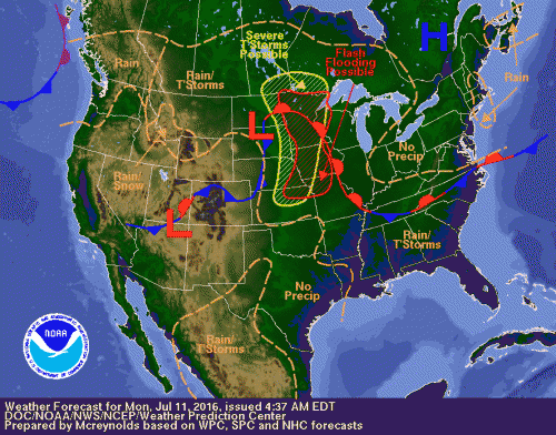
Courtesy of NOAA: Weather forecast for Monday July 11, 2016. Southerly flow in Tennessee and the Carolinas is pushing precipitation down south. Approaching hot and moist air is in place out West. High Pressure over the Northeast brings dry and sunny weather to our vicinity.
The start of the work week will be mild and pleasant after the sultry heat wave that resulted in temperatures in the mid-90s and heat indices above 100F. While today’s forecast will be nice, the heat and humidity will return by the middle of the week. A cold front that moved through on Saturday night has now pushed off the Atlantic coast. In addition, high pressure is currently over the Ohio Valley and extends into southern Maryland. This will allow for lower temperatures, lower humidity, sunny skies and dry weather for today. This system should be shifting in a direction offshore the Atlantic coast throughout today. Immediate effects will trigger storm development west of I-95 and movement of the aforementioned stalled front down south toward a more humid and moist air mass. This front, located above Tennessee and the Carolinas, will have a chance to meander north toward our region before eventually drying out. The combination of the frontal boundary position and the high pressure system will keep most of the storms and moisture to the southeast region of the states throughout today.
Monday
High pressure will result in mild and dry weather for the duration of Monday. Partly cloudy morning skies will eventually lead to generous amounts of sunshine towards the afternoon. Sunshine combined with low humidity will make the high 80s maximum temperatures feel spectacular throughout the day. While the weather is seasonably warm, there is a low to moderate risk for ragweed pollen on Monday and will last through Tuesday. The low humidity, winds, and hot temperatures combined with dry air usually results in higher pollen levels. The evening will continue to be dry and mostly clear of precipitation with lows in the high 60s in the suburbs and near 70 near DC. Expect more clouds and increasing humidity overnight.
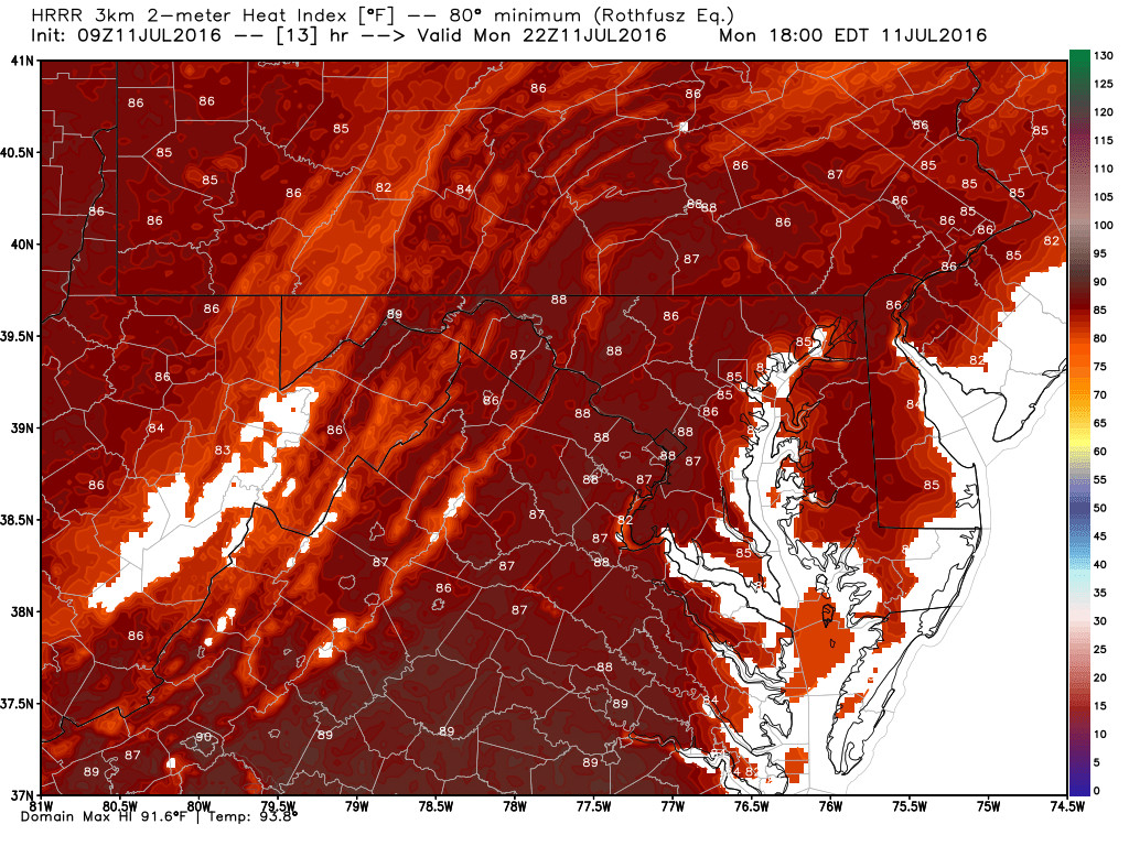
Maximum heat index temperature map reveals that the heat index will be nearly the same as the the forecast high temperatures for the mid-Atlantic on Monday.
Tuesday
As high pressure moves offshore toward the Atlantic, a warmer air mass from the Midwest will expand eastward into the mid-Atlantic making it hotter than Monday. Increased southerly flow of warm, humid air from the southern states will break the pattern of the last two days. Winds blowing from the south are expected to transport hot and moist air into the region increasing the likelihood of afternoon storms and showers. Some of these thunderstorms could linger into the evening but should mainly be restricted to the south and west of the District. Some isolated showers are possible in the afternoon around DC. The forecast area calls for slightly higher temperatures in the low 90s with increased humidity as well. Overnight low temperatures will be near the low 70s.
Wednesday and Beyond
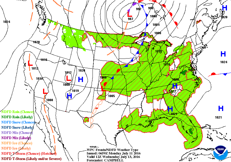
WPC Forecast Map for the US on Wednesday afternoon 2pm
Each day will feature an enhanced chance of pop up thunderstorms, as a warm front from the south lifts through the mid-Atlantic. The heat and humidity returns on Wednesday and lasts for a few days. A zonal air mass flow will give us a break from severe weather but it is still considerable to expect isolated/scattered thunderstorms throughout the remainder of the week. Humidity and moisture creeps a little higher with high temperatures ranging in the low to mid-90s. Once again, when you have increased moisture along with high temperatures the heat index will play a factor in the forecast. The heat indices will increase back up to the triple digits (near 100) until Friday night/Saturday morning when a weak cold front moves through. Toward the end of the week, high temperatures will remain in the 90s but drier air will replace humidity as a weak cold front pushes through our region.