
Today continued the theme from yesterday, beautiful blue skies and ample warmth. Temperatures were even warmer today, as we climbed to over 60 degrees for the first time this week. Although we won’t get back to seasonable temperatures, we will slip back into the low-to-mid 50’s tomorrow with a decent amount of rain to accompany it.
Through Tonight:
A picturesque sunset is on the way as clouds should stay at bay until late tonight. Plans this evening should be accompanied by a light sweater or coat as temperatures will fall into the low to mid 50’s with a southwest breeze calming to around 5-7 mph. Rain should begin to enter the DMV area from the southwest around 2 am, with rain overspreading into College Park by 4 am.
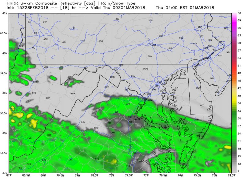
Simulated Radar At 4 AM Shows Rain Overspreading The Area (via weatherbell.com).
Tomorrow (Thursday):
The first day of March will be quite the departure from today’s spring like weather. Temperatures should climb into the low to mid 50’s as rain lingers throughout the day. The rain should not be heavy, but it will be enough to carry an umbrella around for the day. Winds should remain relatively light out of the east. Total precipitation should end up around .25-.75 inches, with locally higher amounts possible if heavier showers develop.
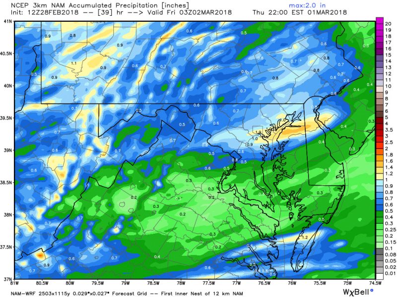
Total Precipitation Forecast Through Tomorrow Evening (via weatherbell.com).
A Look Ahead:
This could be one of the most interesting weather weekends in College Park in sometime. A rapidly deepening low pressure system will “bomb” out and stall off of Long Island. Winds will be impressive this weekend now doubt, and there is a very low, but non-zero chance for a burst of snow. A High Wind Watch has been issued for the entire Maryland area to highlight the threat. Winds could be damaging so be sure to secure any outdoor items. Stay updated!