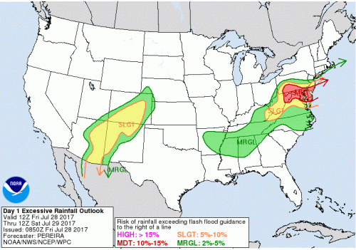
A significant rainfall event is expected to affect the entire DMV area beginning this morning and continuing into tomorrow. A low pressure system moving south-east from the Great Lakes will strengthen as it makes its way into the Mid Atlantic. Some forecasts are calling for total rainfall amounts to reach 2-4+ inches in certain areas. The National Weather Service’s Weather Prediction Center has updated their Day 1 Excessive Rainfall outlook to a moderate risk for the most of the DMV area and extending into southern New Jersey. Flash flood watches have already been issued for all of Maryland, D.C. and northern Virginia.

Moderate risk for excessive rainfall for most of Maryland and surrounding areas. (Via: WPC)
What to Expect:
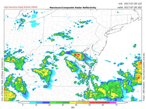
Through Today: To kick off this event, scattered thunderstorms will move over the D.C. area bringing heavy rain during the late morning hours. Temperatures will be in the mid to lower 80s before the rain moves in, and will steadily decline throughout the day. Dew points will stay in the lower 70s throughout the day, keeping humidity high.

Thunderstorms making their way over D.C. and College Park area around noon. (Via: Trowal)
Scattered showers are expected in the afternoon, but the heaviest precipitation will not occur until later tonight. Thunderstorms will move into the area around 8pm bringing heavy rain that will persist through the night. Temperatures will dip into the lower 70s and winds will remain light at about 3- 5 mph out of the NE. Our TerpWRF total precipitation outlook has the College Park area receiving anywhere from 2-3+ inches total by 2 am.

Heavy rain and thunderstorms around 9 pm. (Via: Trowal)
Tomorrow (Saturday): As the low continues to move offshore, rain will stick around for most of the morning. Temperatures will be in the upper 60s to start the day and will only find their way up into the lower 70s. Winds will slowly pick up during the day, starting at around 5-7 mph in the morning and increasing to 12-15 mph by mid afternoon. Scattered showers are expected in the afternoon, but will remain light.
Be Prepared:
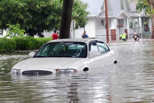
With some areas expected to receive over 4 inches of rain, it is important to be ready for flooding conditions. Low lying areas will flood very easily and may make some roadways incapable of passing. Driving through flooded roadways could cause your engine to stall, leaving you and your car stranded. Trying to start your car with a flooded engine can even cause irreparable damage. Always remember to Turn Around, Don’t Drown! ®

