Forecast Overview
Last week, continuous rain showers drenched the region for more than 3 days due to two separate synoptic systems. An upper-level trough and a tropical onshore flow of moist air from the Atlantic produced gloomy overcast skies and prompted Flash Flood advisories for neighboring locations. As we transition into the first week of October, the DC/MD areas will finally catch some relief and fair weather will become the dominant weather trend for the remainder of the week. High pressure aloft (in the upper atmospheric levels) will linger and generate mostly sunny/clear skies and seasonably comfortable temperatures. Winds coming off the Atlantic coast will lead to another onshore flow of moist air which will impact the amount of low-level cloud cover for the next couple of days. Even though conditions will remain mostly dry, spotty showers are intended for certain areas until Wednesday morning. By the end of the week, the Atlantic becomes a little more active as Hurricane Matthew creeps up near the coast.
Tuesday
Early morning temperatures will start off seasonably cool with low to mid-50’s in the suburbs and mid-to-upper 50’s in the District. Light northeast winds (6-8 mph) from the ocean should suffice ample scattered cloud cover along with a non-threatening chance of afternoon sprinkles. Winds will shift to an east-northeasterly flow and more reliable peaks of sunshine will become mostly sunny in the afternoon. Maximum temperatures will range from the low to mid-70s and low temperatures will drop just below 60 degrees.
Wednesday-Friday
Predominantly dry/pleasant weather will persist until Friday evening. It will be seasonably mild with high temperatures ranging from the upper 60’s (on Wednesday) to the lower 70’s (Thursday and Friday). Light winds will flow from the the east-northeast direction and precipitation chances will increase on Friday evening before the start of the weekend. Low temperatures will range from the mid to upper 50s.
Tracking Hurricane Matthew
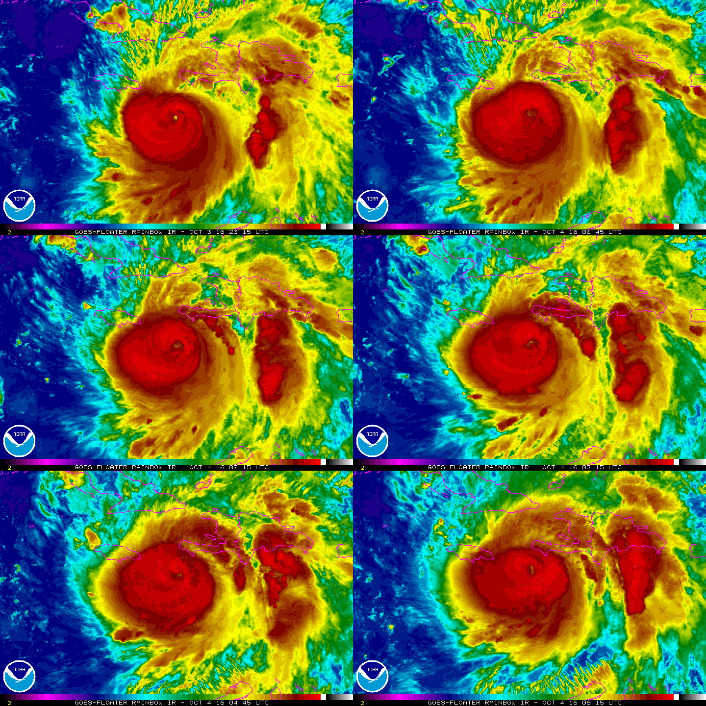
Hurricane Matthew still looms in the Caribbean while maintaining 145 mph maximum sustained wind speeds. The Category 4 tropical cyclone had intensified after experiencing a drop in central minimum pressure. The current minimum pressure of 934 mb (millibars) signifies the recent strengthening of the storm over the Caribbean seas. It is now approaching the islands of Western Haiti and Jamaica. Potential storm impacts are expected to become catastrophic if Matthew maintains its Category 4 strength. The National Hurricane Center favors a storm track towards the southeastern fringes of Florida by Thursday 8pm. As for now, it is still too early to determine whether Matthew will hug the Maryland Eastern shore coastline or drift off into the Atlantic Ocean. But, maximum conditions are anticipated to degrade as the cyclone transitions into a slightly weaker storm.

CREDIT: NOAA GOES FLOATER SATELLITE IR IMAGERY: HURRICANE MATTHEW
