
Today:
Hey Terps, hope you didn’t get too wet from the rain that blew through this week but I bring good news for the weekend! With the low pressure system moving out of the way we can expect sunny and clear skies for our Friday as a high pressure makes its way east. Temperatures will max out in the lower 70s, with a breeze from the northwest clocking in around 5-9 mph. With no rain in the predicted forecast, you can ditch the raincoats and umbrellas for fall sweaters with hot drinks.
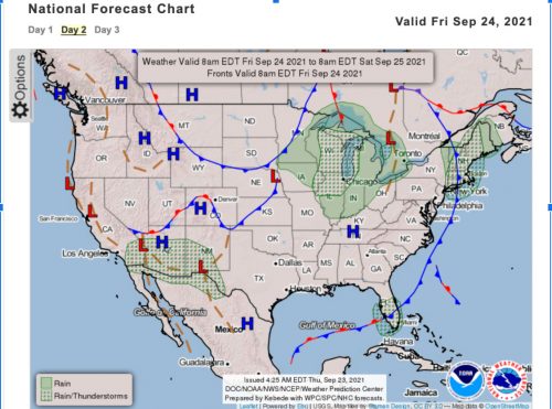
A screenshot of the national frontal map for Friday, shows a cold front moving into the Atlantic ocean and a high pressure system coming from the midwest just in time for the weekend.(Image viaWPC)
Tonight:
Temperatures are predicted to drop into the low 50s for the evening, so make sure to bring layers as you enjoy the outside. The winds will slightly decrease to be around 4 mph coming out of the north. Skies are expected to stay clear for the evening so go out and look for the waning gibbous moon around campus.
Tomorrow (Saturday):
The high pressure system will be moving southwest as we go into the weekend so high temperatures will slightly increase to the mid-70s, with the maximum registering around 75 degrees. Winds will be coming out of the west at around 5 mph. Cloud cover is expected to increase but there is little chance of rain so make sure to go outside during your study breaks and enjoy this fall weather.
Tomorrow Night (Saturday):
It is going to be a bit warmer than tonight with temperatures at around 55 degrees and winds at 5 mph still coming from the west. The sky remains clear as the sun sets, so go out and enjoy your Saturday night Terps!
A Look Ahead:
A high pressure system will be in the region early next week, bringing normal fall weather and dry conditions. On Tuesday, a cold front will begin to move into the region bringing colder weather and possible rain in the evening overnight into Wednesday.
Featured image via Pixabay.com