
Happy Homecoming Terps! The weather today felt like summer again even though we are well into fall now. The high temperature was above 80 degrees with dew points in the lower 70s, making it feel a little uncomfortable. October is not feeling as spooky as it should because the heat is making it hard to enjoy fall activities, like apple picking.
Tonight:
Tonight will remain mostly cloudy, gradually getting cloudier as the night goes on. There is a chance for some isolated showers in the early evening and possibly some drizzle overnight, so keep an eye out just in case. The low temperature overnight will be in the upper 60s.
Tomorrow (Tuesday):
The chance of drizzle remains in the early morning, but then it will clear up. Skies will be partly sunny with a high temperature in the lower 80s, similar to the day before, still warm and humid. There will be a light southerly wind around 5 mph throughout the day. Into the night, skies will become mostly cloudy, and the overnight low temperature will drop into the upper 60s. The light southerly wind will stick around, too.
A Look Ahead:
Hurricane Michael is currently over the Caribbean, but it has the potential to shake things up here later this week. When the storm interacts with the Westerlies it will be pushed out to the northeast, potentially bringing rain to our area. Currently, it looks like the majority of the storm’s effects will stay to our south, but nothing is certain as the path could change. Keep checking our evening updates for updated information about Hurricane Michael.
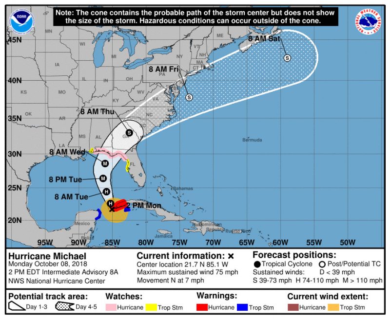
The probable path of hurricane Michael (via the National Hurricane Center).
Featured image via Pixabay.com