
This President’s Day has been a gray and dreary one. Most of this morning’s showers have since moved out of the region, but the cloud cover lingered well into the afternoon. The showers and clouds are associated with a warm front that is a part of a large system currently centered over the Midwest. Today’s temperatures rose slowly into the 40’s, maxing out at 43°F around 3 PM.
Through Tonight
Today’s cloudiness should persist into the overnight hours. That, along with the southerly winds, will keep temperatures from dropping too much tonight. Temperatures should remain in the low-40’s across the DMV. Winds will stay out of the south at 5-10 mph. Some areas may also see patches of fog.
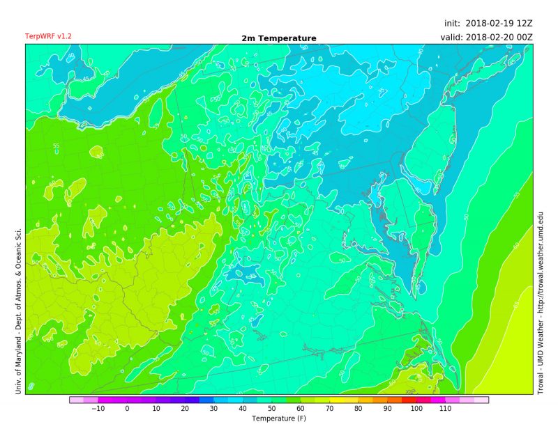
TerpWRF model output showing temperatures around 7 PM tonight (Source: UMD Trowal)
Tomorrow (Tuesday):
You should be able to put away your heavy coats and umbrellas for a while as we move into the mid-week. A major warmup is underway for tomorrow. Tuesday morning should start out cloudy with some areas of patchy fog. Skies should start clearing by early afternoon as a large ridge of high-pressure will build in from the south. Winds will pick up out of the southwest at 5-15 mph. This will help our daytime temperatures to soar well into the 70’s. We may even see some records broken across the area. This little taste of springtime should continue into the day on Wednesday, which has the potential to be the warmest day of the week.
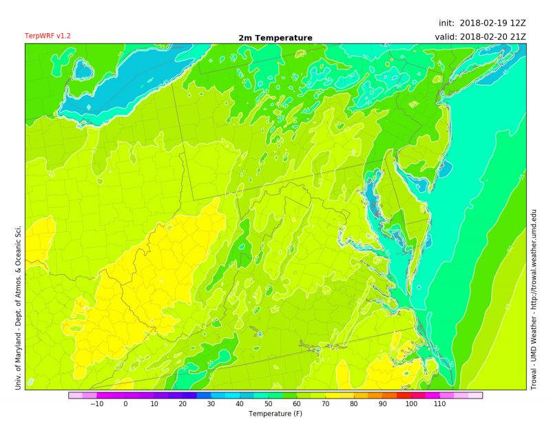
TerpWRF model output showing high temperatures around 4 PM Tuesday (Source: UMD Trowal)