A drenching rain rolled through the College Park area, thanks to a low-pressure system, that will mitigate the drought that’s been grasping the region. Although today and tomorrow’s temperatures will remain relatively mild, this amount of precipitation coupled with last weekend’s temperatures would have made for a winter wonderland with all the projected rainfall we are supposed to get. The steady rain will persist into the remainder of the weekend, so curling up with a good book may be the best course of action.

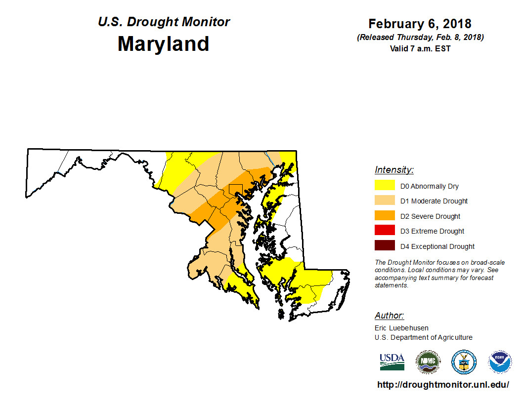
A lot of the region has experienced at least a moderate drought for the past couple weeks. (via National Drought Monitoring Center)
Through Tonight:
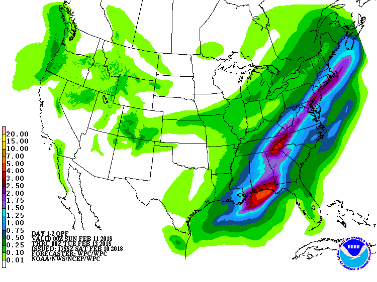
Dreary conditions continue as night falls with some periods of heavy rain possible as well. Temperatures will hover around the upper-4os, paired with a constant southwesterly wind around 5-8 mph. Our much-needed rain will likely accumulate to 1-2 inches, with localities exceeding 2 inches. Patches of fog will also roll in tonight and linger through the early morning hours.
Tomorrow (Sunday):
“Sunday morning and rain is (still) falling” will be the case for the latter half of our weekend (if you get the reference.) Temperatures will rise to the low-to-mid 60s, aided by a southerly wind, 6-10 mph. Rainfall will begin to taper by mid-afternoon, but still expect widespread showers to keep dampening the region. Another half-inch of rain could contribute to the total weekend rainfall.

Projected rainfall through the end of the weekend. (Via WPC/NOAA)
Featured photo courtesy of Pixabay.
