
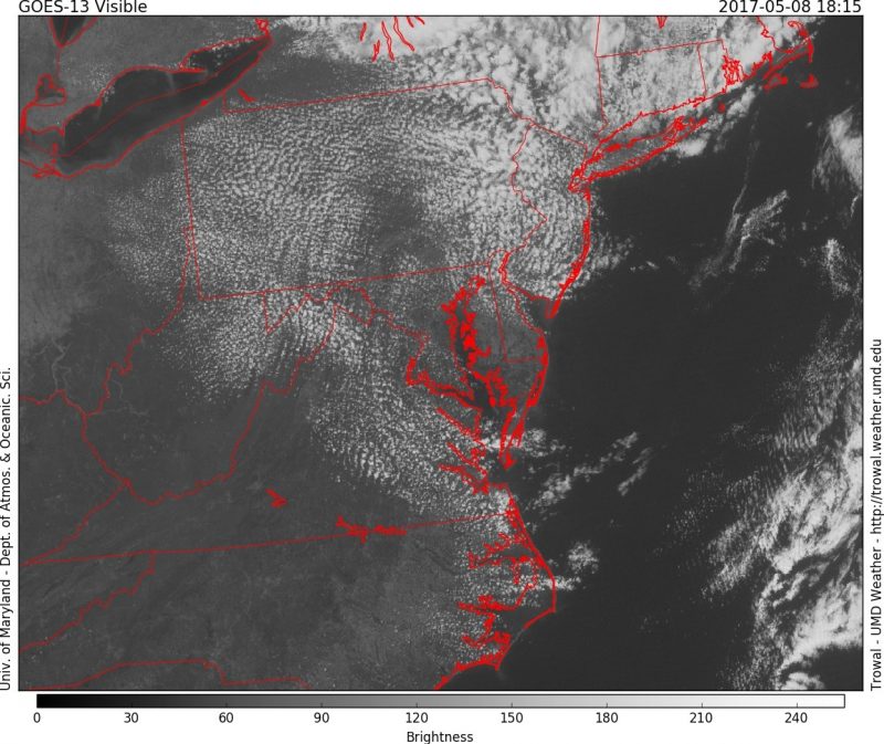
Visible satellite shows mostly clear skies across Maryland (Via Trowal)
After several days of clouds and scattered showers, Monday shaped up to be quite refreshing. Dry northwesterly winds have injected below-average temperatures across the region. These cool and dry conditions will remain through Wednesday. Waves of low pressure will then develop along a stationary front and increase the threat of rain before the weekend.
Through Tonight:
How low will we go? The main story tonight will be how low the temperatures get. Since we are in May, it is very likely many homeowners and companies have planted flowers to add appeal to their property. Most of these plants do not do particularly well with frost, so it is recommended to take the proper precautions to protect them. Low temperatures will dip into the low 40s within and around D.C. However, temperatures in the suburbs towards the north and west could see mid-30s before sunrise. Skies will be clear to help the cooling process and winds will be out of the west at 5-10 mph.
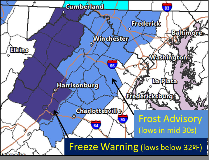
Image via NWS DC/Baltimore on Twitter displaying Frost Advisory’s and Freeze Warnings.
Tomorrow (Tuesday):
Another comfortable spring day on tap. After waking up to temperatures in the 40s, clear and sunny skies will allow temperatures to rebound quickly and reach the mid-60s by afternoon. Winds will be out of the northwest at 5-10 mph, reinforcing the cool and dry air. Temperatures will drop again Tuesday night into the mid-40s. Areas that saw frost Tuesday morning could see another round Wednesday morning, but overall temperatures appear slightly warmer this time around.
Wednesday and Beyond:
Temperatures remain right below the average for this time of year as we head towards the middle and end of the week. Highs for Wednesday, Thursday, and Friday appear to only reach the upper 60s, while lows dip to around 50. There is a slight chance of showers beginning Wednesday night and continuing through Friday. Amounts will be light if any rain falls at all. These showers do have a chance of staying towards the south, however; models have them close enough to cause for watch. Another round of rain looks possible for Mother’s Day weekend. Stay connected with us on Twitter and Facebook for updates!
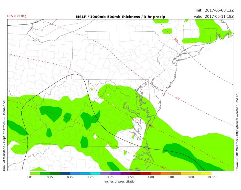
GFS model showing showers possible Thursday afternoon. (Via Trowal)
Featured image taken by the author.