
After a partly cloudy start, the sun rose high in the sky to start off this mid-April day. Once the clouds burned off, the sun was able to heat the ground pretty quickly causing the daytime high to reach a balmy 71 degrees. No chance of rain was in the forecast, which kept the skies blue and mostly clear. To top things off, a calm breeze came in to help cool off the afternoon.
Through Tonight:
Tonight will stay clear before clouds start to move in after the sun sets on the second day of the week. The night time low will dip down into the tolerable lower 50s with 40s towards the north. The winds will stay fairly calm between 3 and 8 mph. If you’ll be working on final projects, don’t worry about bringing an umbrella with you to the library. Rain will stay far out of the forecast tonight.
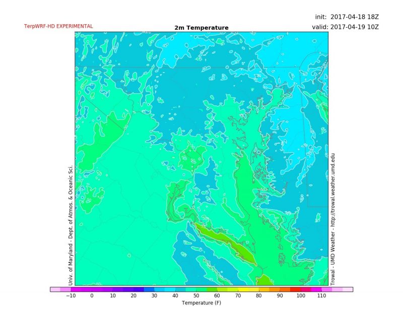
Overnight temperatures will dip into the low 50s around D.C. with low 40s possible towards the north. (Via Trowal)
Tomorrow (Wednesday):
Wednesday will start with cloudy skies and high temperatures reaching into the mid-to-upper 60s. The sun may peak out in between those clouds before lunch time, but the day will end overcast. An isolated shower or two may invade just in time for those late evening classes around 6 pm, so bring an umbrella to be on the safe side. The winds will be coming out of the southeast around 5-8 mph. Temperatures will dip into the mid-50s during the night so bring a jacket if you’ll be pulling an all-nighter.
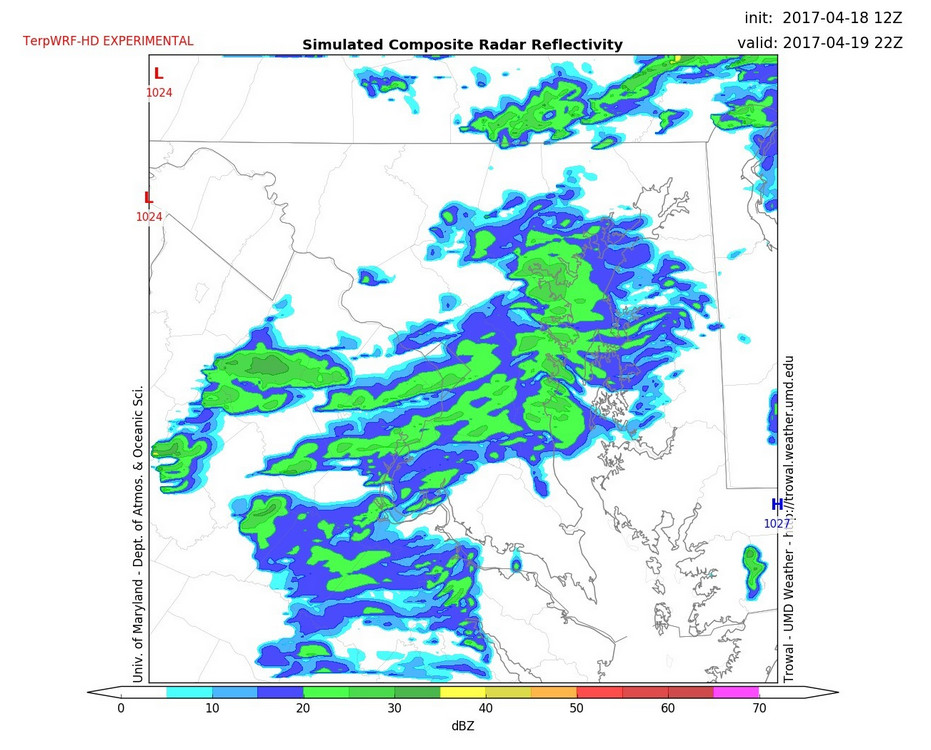
The rain probability is shown around 6 pm Wed. from TerpWRF-HD.