
Well, we already know a winter storm is approaching the area tonight. Let’s take one more look at the set-up. One low-pressure system is coming from the west moving east. Another low-pressure system is riding up the East coast. Low-pressure system #1 is going to weaken as it approaches Low-pressure System #2, and transfer #1 energy to #2. This will cause low-pressure #2 to strengthen rapidly cause heavy precipitation and high winds along the coast and inland areas. This big question is how much snow. College Park and Washington D.C are both on the edge between a lot of and a small amount of snow. However, The University of Maryland has already announced it is closed for tomorrow. For more in depth snowstorm coverage go to our earlier post here.
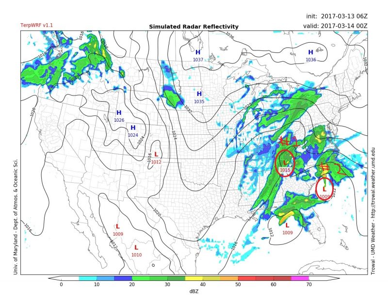
This image from TerpWRF shows the two low pressure systems starting to interact at 7:00 PM tomorrow
Through Tonight:
Precipitation will start out as light snow at around 8 PM and will increase throughout the night, perhaps changing back to sleet. Snow/sleet could be heavy at times. Lows in the low 30s. Winds Southwest 10-20 mph with gusts up to 40 mph. Snow accumulations can vary greatly across short distances. Areas North and West will get more snow while areas South and East will get less.
Tomorrow (Tuesday):
The Morning will continue snowy. Snow still could be heavy at times. The snow will slowly lessen as the day continues. The high will be in the mid-30s with Northwest Wind at 15-20 mph with gusts up to 30 mph. With the University closed tomorrow people should stay home until late afternoon. Tomorrow evening temperatures will drop to low 20s. Watch for slippery spots on the road as anything melted will re-freeze.
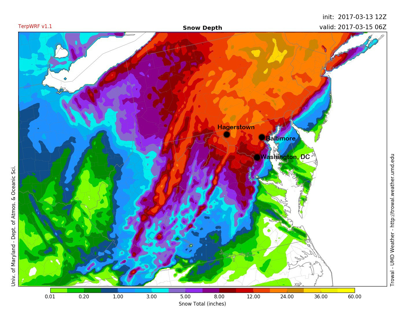 TerpWRF Preliminary Storm Totals:
Washington D.C: 4-8″
Baltimore: 6-10″
Hagerstown: 12-15″
Keep an eye for updated storm information and snow totals tonight and tomorrow on Social Media and our website.