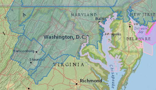
Winter Storm Watches are posted for the counties in blue. (Via NWS)
The stage is set and Mother Nature has showed her hand, we are within 36 hours of a major March snowstorm. Winter Storm Watches have been posted for areas that could see over 5 inches of snow. These will most likely be upgraded to Winter Storm Warnings sometime tonight. Let’s dive right into the details with our very own snowfall map below.
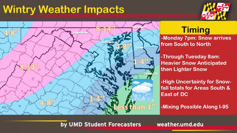
Our experimental TerpWRF model:
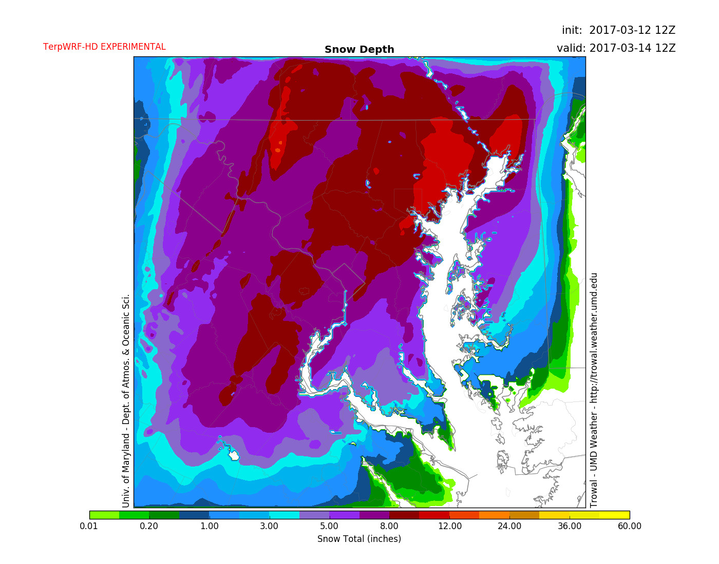
Output from 1km TerpWRF (experimental) shows a widespread 4-8 inches across the region by Tuesday.
Storm Set Up:
This is a complicated system and has been a very difficult forecast over the last few days if you haven’t noticed. An area of low pressure is moving across the midwest tonight. This will move south eastward until it gets closer to our area. Once it does this, the energy is transferred to the coast and a Nor’Easter is formed. It is also very fast moving, so accumulations will have to come down hard if you want really big snow. If the system was slower we would be looking at a record-breaking storm.
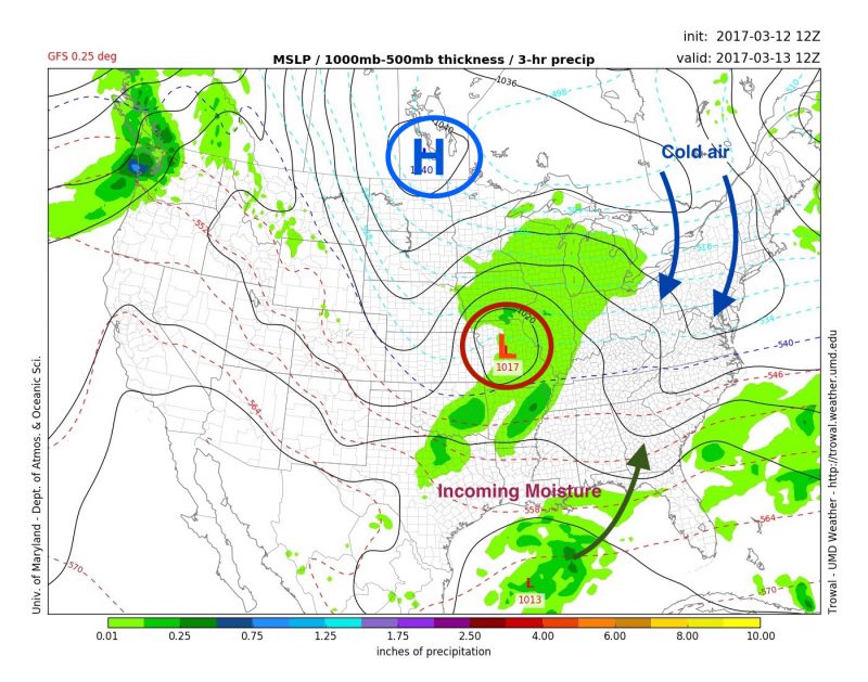
Surface map with precipitation at 8:00 am Monday, via GFS model. (UMD Trowal)
What Could Go Wrong?
The two things that could cause very little snow would be…
- The rain/snow line pushes west into the College Park area
- A dry slot sets up over central/southern Maryland after a heavy band of snow sets up to the north.
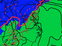
SREF model shows rain/snow farther west compared to the GFS model. (Via NWS)
The storm can also do the opposite and the rain/snow line could set up farther east. This would lead to more snow over D.C. and southern Maryland. However, this scenario is seeming more unlikely.
Timeline:
Here’s our current understanding on how the storm will play out.
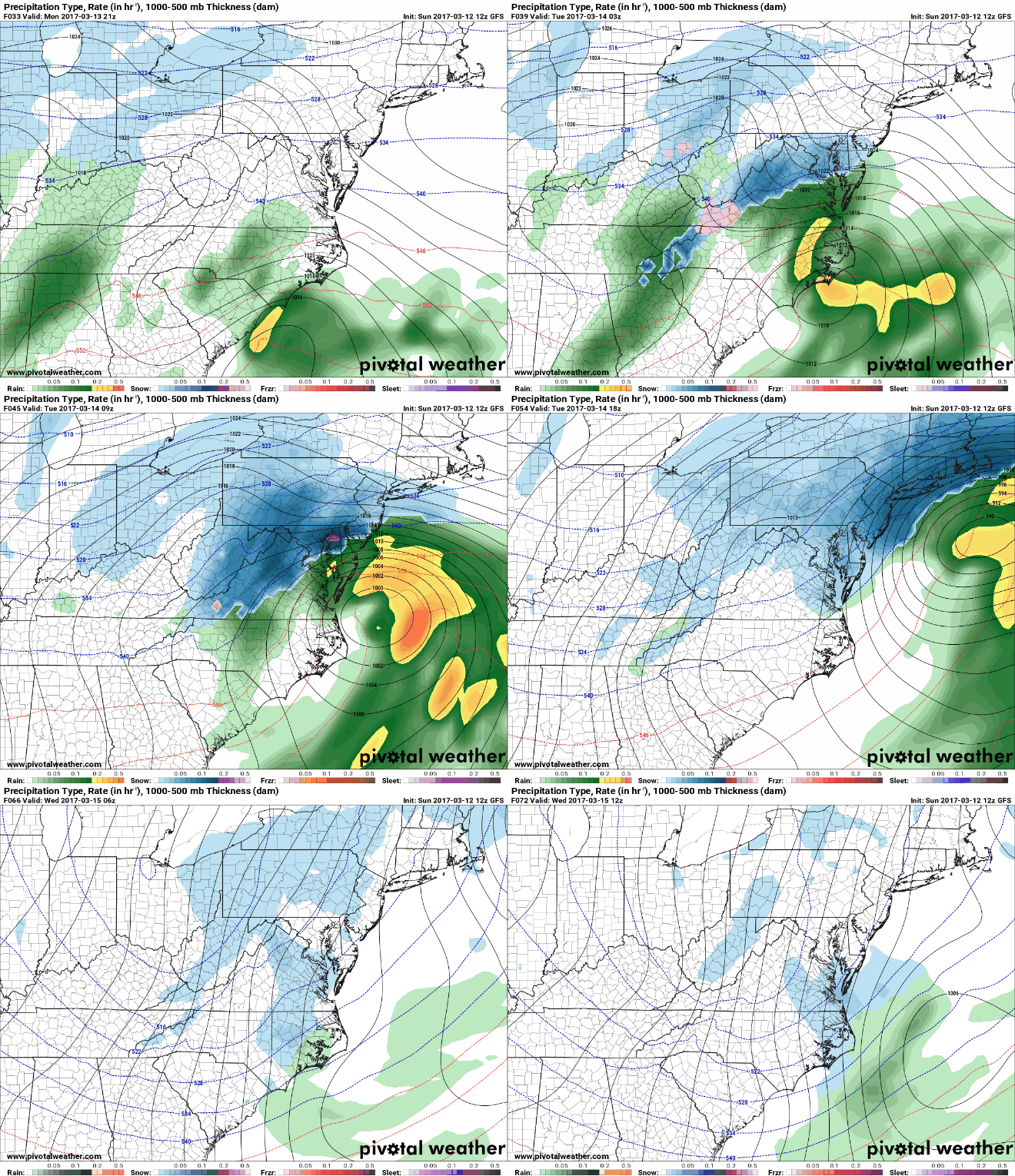
Depiction of how the GFS is showing the storm progress. (Via Pivotal Weather)
Monday Night
7:00 pm – 1:00 am
Precipitation overspreads the region from south to north after sunset. Temperatures will start out ranging between 32-35 degrees, so accumulations may not start in the D.C. metro region immediately. Areas toward the north will be cold enough to support accumulation so plan ahead if traveling. Temperatures then drop and snow rates pick up. Some mixing becomes possible to the south and east as the middle layer of the atmosphere warms a bit.
1:00 am – 7:00 am
Snowfall rates increase dramatically and accumulations really start as temperatures remain below freezing. Areas towards the south and east mix with some sleet. The rain/snow line will push west, but how far exactly it pushes is a big question and will determine who sees no snow or a lot. Winds will pick up to 15-20 mph out of the northeast. This is also the time period where thunder snow is possible!
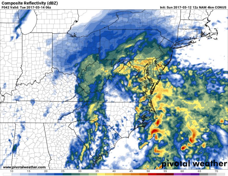
Composite reflectivity from the NAM shows heavy precipitation rates at 8 am Tuesday. (Via Pivotal Weather)
Tuesday
7:00 am – 12:00 pm
Snow is still heavy until around 9 am, but lightens by noon with only snow showers remaining. Temperatures will still be below freezing as the high sun angle of March appears. This will cause some daytime melting even if temperatures stay below freezing. Winds still gusty at 15-20 mph out of the north.
12:00 pm – 11:00 pm
Precipitation clears out and the wind will die down for the afternoon. Things then may pick back up with some back-end snow and wind around 8 pm. This is still uncertain, but don’t let your guard down as the sun will set and any snow will stick.
Additional Hazards:
Wind
Traveling will be very difficult overnight Monday and Tuesday morning. The weight of the snow could also cause trees and power lines to come down ,causing scattered power outages across the region. Winds will be gusty from Monday night through the bulk of Tuesday, with the peak wind speeds coming on Tuesday morning. Gusts of 25+ mph are likely, with even stronger winds along the eastern shore.
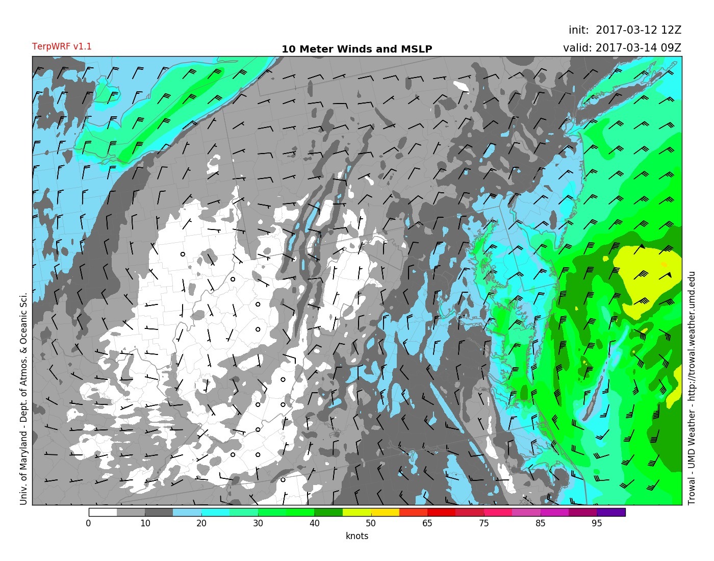
TerpWRF shows wind strong wind gusts at 5am on Tuesday morning.
Follow us on Twitter and Facebook for updates and we will be updating this forecast on Sunday evening.
