Another winter day with above average temperatures. What’s new? March has brought us more seasonable weather than our warm February did, but it’s hard to complain about 7o degree weather anytime of the year. Enjoy today, because this weather will not be here next week.
Through Tonight:
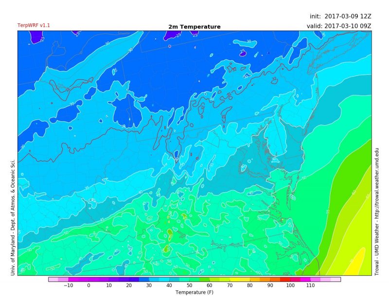
Clear skies will stick around before midnight, but as a system moves in, we likely will see some rain showers by the time we wake up on Friday. Temperatures will dip down fairly quickly after sunset to the low to mid 40s, aided by clear skies. Gustier winds during the day will have diminished as well.

College Park nearing 40 degrees tomorrow morning. (via UMD Trowal)
Tomorrow (Friday):
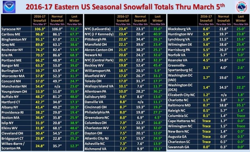
Tomorrow will be something to watch. A low pressure system predominantly to our north will probably keep areas College Park and southward wet, but areas to our north may very well see some light snow during the day. Projected high temperatures into the mid 40s will probably hold back our chances for meaningful accumulation, however don’t be surprised if some flakes fly throughout the day. Winds will start to pick up throughout the day as well, gusting upwards of 20 mph. Sorry snow lovers, it looks like the DC snow hole for this winter will continue.

Snowfall totals in the eastern U.S. for this winter. DC locales are extremely low compared to nearby places in Virginia and Pennsylvania. (via NOAA)
A Look Ahead:
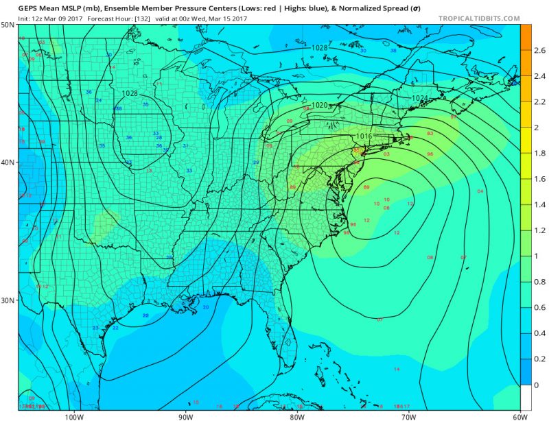
“Potential snowstorm headed our way?!” It’s a broken record at this point, but yet again, models are looking hopeful to some type of wintry weather early next week. There is a lot of uncertainty in where the low pressure system would track, but nonetheless, the potential for snow is there. Stay tuned this weekend as we learn more!

The red numbers indicate the possible locations of the low pressure system of interest next week, which are very spread out currently. (via Tropical Tidbits)
(Feature photo courtesy of Pixabay)
