
Forecast Overview
Increasing humidity levels will make our Friday feel muggy and uncomfortable for today. Later, an approaching cold front will make its way in from the Ohio valley igniting thunderstorms in the late afternoon and early evening. Saturday and Sunday will be much drier and sunny as high pressure moves in for the weekend. A low-pressure system that approaches the region on Monday will make it more cloudy and increase the potential for rain on our 4th of July holiday.
Friday
Friday will pretty much feel hot and sticky! Dew-points near the mid 70s will make the mid-80 degree temperatures feel more like the upper 80s and low 90s in some areas! An approaching cold front will stir up possible afternoon thunderstorms and heavy rain sometime after 3:00pm. So, today’s summertime heat, moisture and the oncoming cold front will put us at a 50% chance of having evening scattered thunderstorms that will most likely exit our region after midnight. Winds will remain light and variable as these storms move through.
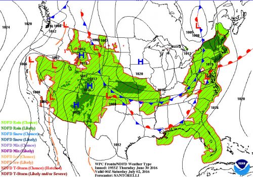
WPC Short Range Forecast Friday evening. Cold front pushing toward Maryland area bringing in moisture and likely chance of rain)
Saturday/Sunday
 Saturday and Sunday will be perfect for your holiday cookouts! High pressure moving in will bring in nice weather over the weekend. Clear and dry weather will accompany this system on Saturday morning and stick around until Sunday night.
On Sunday, more clouds roll into the region. Humidity will slightly increase but not enough to make it feel sticky outside. Light winds will bring cooling breezes throughout the day. The possibility for a stray shower or storm (25%) is in the effect on Sunday, but it won’t be a major threat to any outdoor plans that you may have. Sunday night lows will be warmer with temps in the mid to upper 60s. The suburbs should be slightly cooler than the urban areas. Higher humidity will return overnight making it feel muggy enough to turn on your air conditioners.
Monday 4th of July!
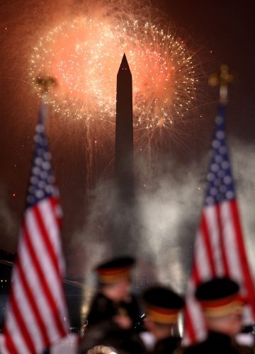
WASHINGTON, DC – JULY 04: Fireworks display during A Capitol Fourth 2015 Independence Day concert at the U.S. Capitol, West Lawn on July 4, 2015 in Washington, DC. (Photo by Paul Morigi/Getty Images for Capitol concerts)
The Independence Day forecast still remains a little uncertain but its safe to say that you should keep an umbrella close to you throughout the early afternoon and into the evening. Storms/rain may be approaching the area after lunchtime but uncertainty is giving us some difficulty of letting us know when and where these storms will exactly hit. On the good side, temperatures will be in the mid to upper 80s depending on the amount of cloud coverage and rain that we get.
So overall, you definitely want to pack an umbrella for Friday night and throughout most of Monday because there is a good chance of afternoon/evening thunderstorms. Therefore, it is best to make earlier 4th of July cookout plans on Saturday or Sunday while the weather is projected to be comfortable and mainly clear of precipitation. Holiday traffic can be kept to a minimum if folks plan ahead and leave out before or after the evening storm activities. To see how our Monday holiday turns out, check back over the weekend for our daily weather forecasts. Have a great and happy Independence Day weekend!