
Good morning, Terps! If you have finals on campus or plan to be outside today, make sure you are bundled up, as we will have a very chilly and breezy start to the week. These freezing conditions aren’t expected to stick around for long, though; temperatures are expected to gradually warm into the 40s and 50s by midweek.
If you are commuting or walking to campus this morning, please take extra care when travelling! Lingering snow/ice from the weekend poses dangers to those travelling on roads and sidewalks.
Today:
Before sunrise, temperatures will feel very, very cold for our area. Our area is expected to have breezy and gusty conditions that will result in temperatures that feel below 10 degrees. As the sun rises, the breezes stick around and keep temperatures feeling low; morning daytime temperatures will feel around 20 degrees. Winds die down in the afternoon, but temperatures will remain cold. Overall, be prepared for a very breezy and cold day today, and make sure to bundle up with hats, gloves, and warm coats.
Tonight:
Winds die down by the evening, but temperatures will still be fairly cold. Expect temperatures in the mid to low 20s and light breezes.
Tomorrow:
Look forward to a mostly sunny Tuesday with calm breezes. Expect sunrise temperatures in the mid 20s before warming up to the upper 30s before sundown.
Looking Ahead:
For the rest of the week, expect temperatures to warm, with Wednesday temperatures in the 40s and Thursday temperatures in the 50s. There is a chance of rain on Thursday night. On Friday, temperatures begin to cool into the upper 30s and 40s alongside the arrival of some breezier winds.
Discussion:
A cold front passing on Sunday and the resulting buildup of an arctic high are the result of the frigid temperatures and winds from the overnight. The winds and cold temperatures following this system still lingers as this system exits, but these conditions should die down as the arctic high exits by the end of the day today.
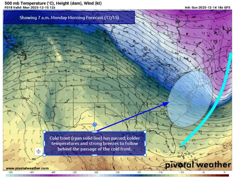
Via www.pivotalweather.com
With the exit of this arctic high, high pressure builds up to our South, which will contribute to calmer winds. By the end of the day on Tuesday, this high pressure shifts offshore. This shifting pattern will result in zonal winds in the upper-levels and lower-level warm air advection, which is the main reason for the warming temperatures in the midweek.
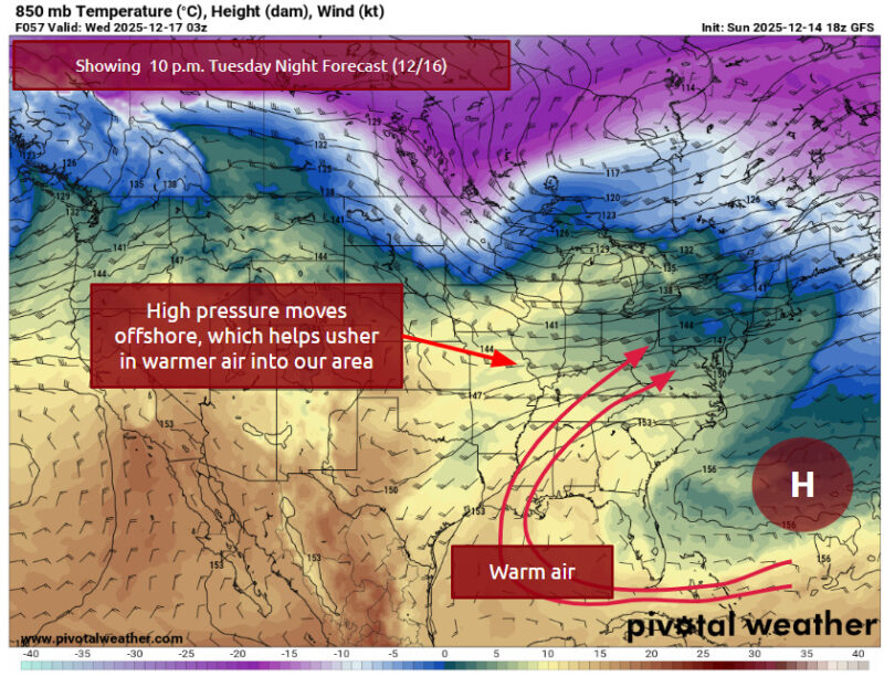
Via www.pivotalweather.com
A cold front will pass through on Thursday night, which will lead to notable amounts of rain. Once this front moves offshore, we should experience a cool-down on Friday and into the weekend.
Best of luck on your finals, Terps! Stay tuned for an updated forecast later in the week.
- Writer: Frances Schoenly
Featured image via Ryanna Naithram