
Wow. This has been one beautiful week of pre-break weather. I mean, upper 70s in early March? Seems like my buddy Phil over in Punxsutawney may have been wrong with his predictions for these next six weeks. Maybe getting our weather news from a reliable source like NOAA instead of a groundhog is a good idea. I wonder what other important things we should trust NOAA on instead of the 1% of spring-denying scientific rodents…
Today:
Unfortunately, yesterday’s maximum temperature of around 80 degrees F will be the max of the week. Temperatures today will only hit a high of about 67 degrees F (still beautiful), but also cloudy, leading to a cold night with lows in the mid 30s.
Tomorrow (Saturday):
Tomorrow will be even colder than today, with highs around 55 degrees F and lows right around freezing. Expect little to no cloud cover, so this early spring sun should provide some extra patches of warmth when you reminisce on the glorious warmth of this past week.
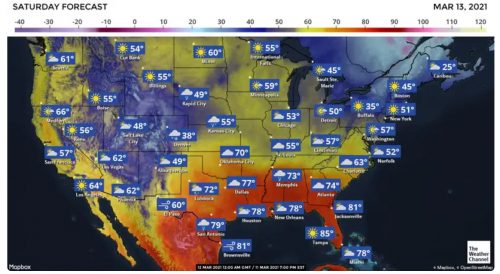
This recent run of warm weather starts to recede into the south over the next few days. Here’s what Saturday looks like. Image via The Weather Channel.
A Look Ahead:
The next 10 days look a lot like Saturday: highs in the mid 50s, lows in the low 30s. Some precipitation is likely to come into play this next week, with rain expected on Tuesday and Wednesday.
featured image via Ali Husain