Today in College Park we were able to enjoy some very pleasant spring weather, with a high of just 64 degrees and a beautiful breeze making for cool conditions. Winds peaked at around 9 miles per hour, with gusts possible at times up to 20 miles per hour. Skies were cloudy most of the day, as one would expect with the backdoor cold front that approached the region.
Tonight: Wednesday
Expect conditions to remain pleasant going into tonight, with a low of around 51 degrees and winds remaining similar to what we experienced during the day. Clouds will continue to persist into the night, with the added benefit of trapping some heat in for us and keeping temps from going lower. Generally speaking, you should be good to go out wearing nothing more than a light jacket if temperatures are still a dash too chilly for you.
Tomorrow: Thursday
Moving along into tomorrow, be prepared for a large swing in temperatures as a surface low begins its development in the region, something that will factor in largely for the weekend. Temperatures are expected to peak near 80 degrees, even with the cloudiness we will likely see tomorrow. Winds will likely be similar to today, although gusts up to 25 miles per hour will be possible. With temperatures expected to go so high, it may be time to break out the shorts to keep cool tomorrow.
The Week Ahead:
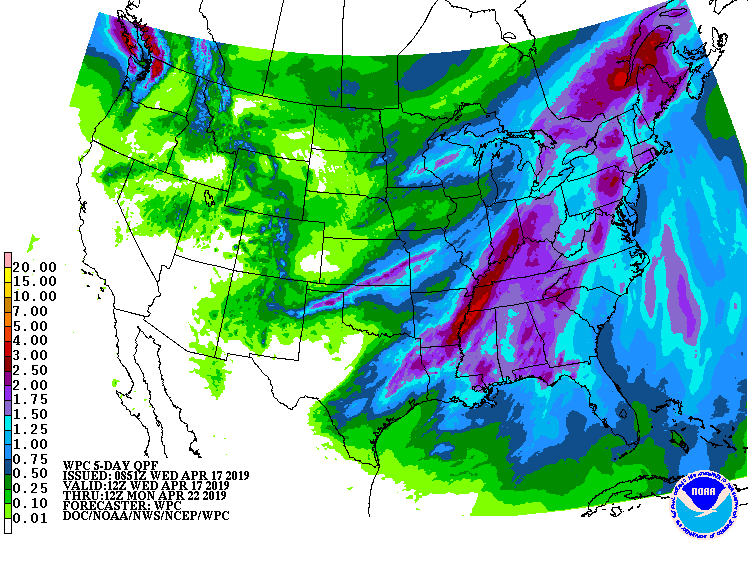
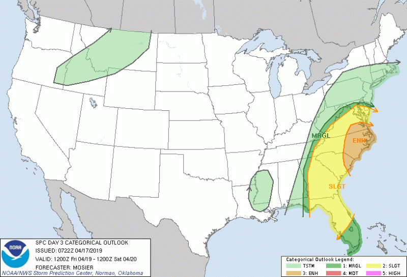
Looking ahead into the weekend it looks like things are going to be very wet indeed. Beginning Thursday evening, a stationary front is expected to setup in the Mid-Atlantic and Appalachian mountains. This front will provide the beginning stage for a surface low to develop before the system inevitably moves our way and is overhead by Friday. This system is currently forecast to be packing a tremendous amount of moisture; latest model runs indicate a PWAT values of up to 1.78 inches, PWAT being the amount of precipitable water in the atmosphere. Should this turn out to be true, we could set a record for that parameter, and current rainfall totals reflect this. Up to 2 inches of rain could be expected over the weekend, with a chance of thunderstorms throughout Friday and possibly into Saturday. For the time being, severe potential seems limited due to the large scale rain event preventing much in the way of rapidly rising air. However, with the way winds are forecast to turn as they increase with height, there will be a possibility for perhaps a severe thunderstorm to produce a limited tornado.