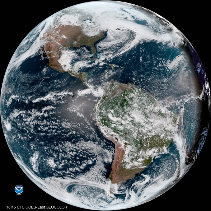
While Maryland and Northern Virginia managed to be spared from the worst impacts of the latest Nor’Easter to move though the region, College Park has still felt some of the power of this awesome storm into today. With winds currently ranging from 8 to 14 miles per hour and gusting as high as 24 mph, it would be hard to tell that Spring is approaching, with the biting winds making the 46 degree max reach today feel much colder than the thermometer read. The surprisingly gusty winds are the result of the Nor’easter undergoing bombogenesis, or rapid strengthening of the system, with the central minimum pressure of the storm dropping an impressive 28mb from 11am Monday through 11am this morning. As a result, the region will continue to see windy conditions for the next two days at least.

The Nor’easter as seen from GOES-16 at 3PM today (via NOAA GOES EAST IMAGE VIEWER)
Through Tonight:
Thanks to the large wind field of this Nor’easter, winds will remain relatively the same overnight ranging from 9 to 14 miles per hour and with gusts still possible up to 24 miles per hour. Unlike the previous night however, our chances of precipitation are near zero with the passage of the Nor’easter ruling out a repeat of last night’s snow and rain event.
Tomorrow (Wednesday):
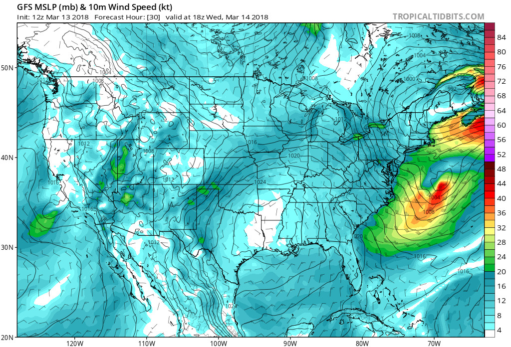
Unfortunately for tomorrow, weather in the region is likely to remain the same with a high of 43 degrees and a low of 28 degrees. Winds will likely increase, ranging from 9 to 14 miles per hour before peaking to 20 miles per hour in the afternoon, with gusts up to almost 30 miles per hour still possible. Although skies should still remain clear, it will definitely be the right day to bring your windbreaker or better yet a coat for winds this strong.

GFS Model Output for 10m Wind Valid at 2PM Wednesday, indicating stronger winds to come. (via Tropical Tidbits)
The Week Ahead:
Although one would think the passage of the Nor’easter would bring better weather, it is likely that the opposite will actually happen. Thanks to the presence of a strong upper level trough aloft over the region for the next few days, temperatures will continue to remain in the mid to upper 40s for most of the week, and the night will see the return of below freezing temperatures at times. In fact, it is the deepening of this trough that will bring the windier conditions on Wednesday, before the trough begins to exit the region by early Saturday before the arrival of another smaller trough. That being said, it would be a good idea to keep your winter gear handy even with the first day of spring drawing near on March 20.
