Winters in Maryland can be wild and hard to predict. Just look at the roller coaster our weather was on a week ago; spring warmth one day and quarter sized snowflakes the next. Luckily, meteorologists can use clues and patterns in the atmosphere to help forecast larger scale weather patterns further out in time. Some of these clues we like to call teleconnections. What makes a teleconnection unique is that these are essentially casual connections that often occur a long distance apart. Believe it or not, the atmosphere’s behavior in the tropical Pacific can have an effect on the weather right in your backyard! One of the most talked about teleconnections in the winter is called the North Atlantic Oscillation, or NAO, and it’s poised to become a very popular topic over the next month.
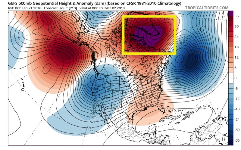
A clear signal of a negative NAO are higher than average geopotential heights over Greenland. Read on to learn more. (Via Tropical Tidbits)
What is it?
The NAO is a natural phenomenon, just like El Niño/La Niña, which is also a teleconnection. However, instead of being located in the middle of the Pacific Ocean it is situated over the middle Atlantic. According to the NOAA National Centers for Environmental Information, the formal definition of the North Atlantic Oscillation is the surface based pressure difference between the Subtropical High and Subpolar Low (seen below). The Subtropical High is located over the central Atlantic and is otherwise known as the Azores High, whereas the Subpolar Low is located over Greenland. The NAO has two phases, positive (first figure) and negative (second figure), and the figures below describe the differences between the two.
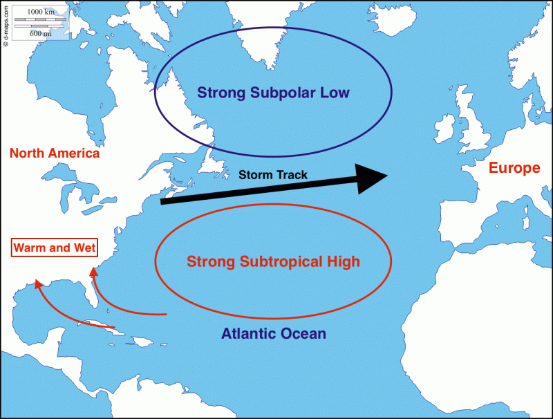
The positive phase of the NAO leads to warmer and wetter weather in the eastern United States, due to a strong Subtropical High and Subpolar Low. This causes southerly winds, bringing warm and moist air from the Southeast U.S. This phase also allows for storm systems to easily cross the Atlantic Ocean from the U.S. to Europe.
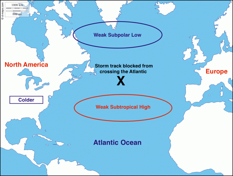
The negative phase of the NAO leads to colder temperatures in the eastern U.S. since storm tracks are blocked from crossing the Atlantic Ocean. This leads to more unsettled weather and less southerly flow from the warmer waters of the Gulf of Mexico.
What does it mean for Maryland?
As we saw above, a positive NAO usually is associated with warmer and wetter weather in the eastern United States. Meanwhile, a negative NAO usually leads to colder and therefore snowier weather. The key word here is “usually” because only using the NAO by itself can have its limitations. A good example of the NAO being a good forecasting tool was in the winter of 2009-2010. The famous and extremely snowy winter had a pronounced negative NAO, which can be seen below. However, using the NAO can have its drawbacks, like January of this year. The NAO was positive while Maryland was freezing.
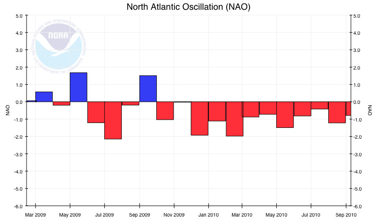
The snowy winter of 2009-2010 experienced a negative NAO. (Via NCEI/NOAA)
What phase is the NAO in now? Where will it be for the rest of winter?
Currently, the NAO is neutral/slightly negative. This means the NAO has little influence on our record-breaking warm weather this week. However, the reason why the NAO will be a hot topic over the next month is because the NAO is projected to tank deep into the negative phase.
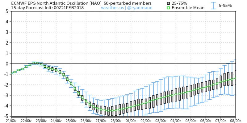
This chart from the European Centre for Medium Range Forecasting shows the NAO extremely negative to start the month of March. (Via Ryan Maue)
With the NAO turning negative it can be expected that Old Man Winter won’t be going out without a fight. However, other factors will help determine whether March will be cold, warm, snowy, rainy, dry, or somewhere in between. As always, stay tuned to UMD Weather throughout the rest of the season to find out how accurate the NAO was this time around!
Featured image: Snow on cherry blossoms via Pixabay.com
