
After some torrential rain this weekend, which helped to mitigate the moderate drought affecting most of the region, our weather returned back to normal for mid-February today. Today was still a rather chilly day, but the rest of the week should feel more comfortable. Ready for some 70s Thursday?
Through Tonight:
Tonight will be on the uneventful side except for a thick blanket of clouds that will only increase throughout the night. Low temperatures should drop to around the freezing mark, with attendant light winds out of the south.
Tomorrow (Valentine’s Day):

Tomorrow will feel more like early spring. (via Pixabay)
Love will be in the air, and so will pleasant temperatures for Valentine’s Day. High temps will rebound into the mid to upper 50s with south winds around 5 mph. Skies should clear up a bit and become mostly sunny by afternoon, but watch for a chance of showers tonight. If you’ve got any special plans tomorrow night, make sure to grab a rain jacket before you leave the house.
A look ahead:
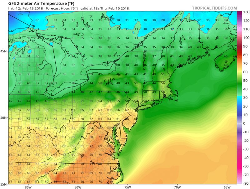
Potential record-breaking temperatures for much of the area as we flirt with the 70 degree mark Thursday. (via TropicalTidbits)
The past two weekends have shown us copious rain, and combined with our mild week ahead, you may be thinking that winter is just about cancelled now. Don’t count winter out just yet; it is far out but some weather models are yet again hinting at a snowstorm for this weekend. The hype train isn’t quite at full speed yet, but this weekend will be something to watch!
Feature photo courtesy of Pixabay.