
Monday started out as a repeat of yesterday’s warm and sunny skies. Clouds have now rolled in as an area of low pressure approaches. Today was a good day to sit out on McKeldin Mall once the grass dried from the sprinklers this morning.
Through Tonight:
Clouds continue to move in and rain chances increase as evening goes on. The greatest chance of rain, with possibly some thunderstorms, will be after 6 pm to about 3 am on Tuesday morning. Showers will continue to move through as sunrise approaches. This is still much needed rain as the area is still in a moderate drought. Lows will fall only to the mid-50s. Winds will be from the southwest at 9 t0 13 mph, gusting up to 20 mph.
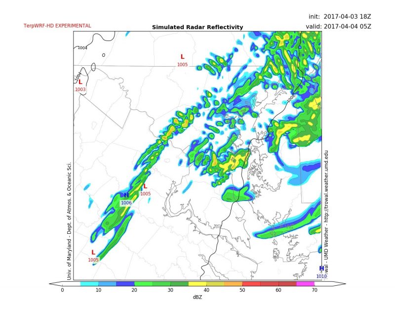
This image from TerpWRF HD showing a line of showers and moving through the area around 1 am.
Tomorrow (Tuesday):
Mostly cloudy skies from the early rain will clear up to mostly sunny skies by the afternoon. Showers will completely exit the area by around noon. Total rain amounts will be around a quarter to a half inch. The afternoon sun and southerly winds will warm up the region’s temperature to the mid-t0-upper 70s. The winds will be stronger than what is was on Monday at 10 to 17 mph with gusts around 25 mph. The evening will be partly cloudy with lows in the low 50s. Winds will shift from the west at 7 to 14 mph.
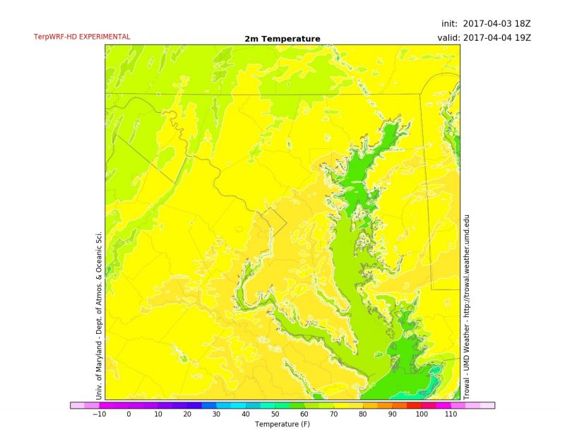
This image from TerpWRF HD shows the high temperature tomorrow will reach in the upper 70s
Extended Outlook:
Entering mid week temperatures should remain above average until a cold front swings through by Friday. The low pressure system associated with this cold front will increase rain chances from Wednesday night through Friday. Some thunderstorms are possible on Thursday.
Be sure to follow UMD Weather on Twitter and Facebook so you are never caught off guard by severe weather this spring!