

Trees are showing some beautiful color across the University of Maryland this week. (Taken by the author)
Overview:
Students and faculty arrived from spring break this morning under a thick fog. This kept temperatures cool until mid-morning, when the sun finally broke through. Sunshine, as well as a southerly breeze, has allowed temperatures to feel more spring-like through the afternoon and into the evening. This warm theme will continue, but rain chances will increase throughout the night and into Tuesday.
Through Tonight:
Skies become cloudy and temperatures stay mild in the mid-50s overnight. Showers are possible with a rumble of thunder not out of the question. Rain amounts will be light and less than a tenth of an inch. Winds will also be light and out of the southeast around 5 mph.
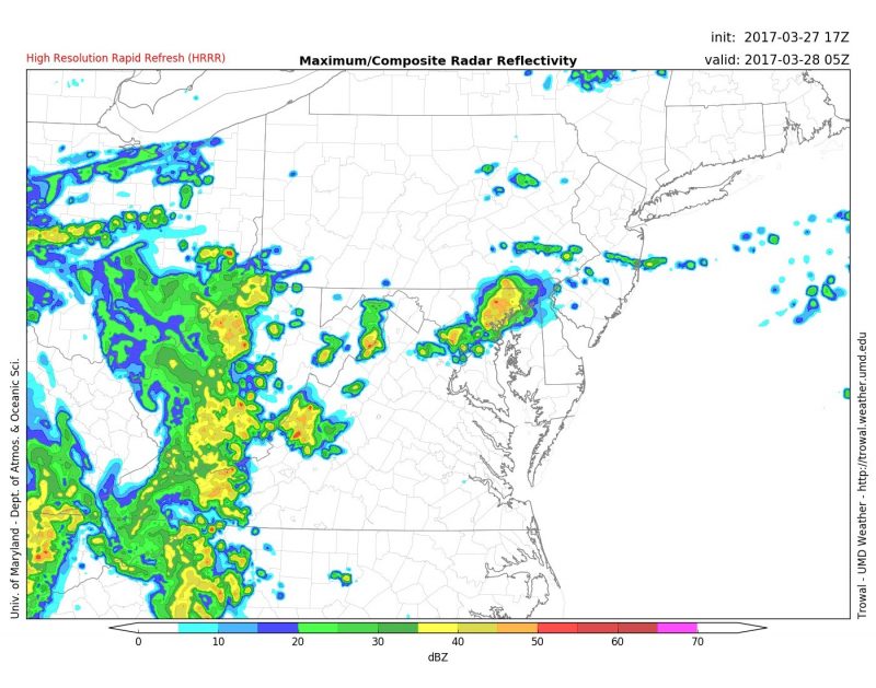
HRRR model showing moderate showers over central Maryland around 1 a.m. (Via Trowal)
Tomorrow (Tuesday):
Another gloomy, but warm day is on tap for Tuesday. Showers are possible in the morning as temperatures rise out of the 50s and reach the low 70s by mid-day. This warmth will allow heavier showers and some possible thunderstorms to form ahead of a cold front in the afternoon. The Storm Prediction Center currently has College Park in a marginal risk for severe weather on Tuesday. The most likely chance for these thunderstorms will come after 2 p.m. and increase as we head into the evening. Rain amounts will total around a tenth to a quarter of an inch, with heavier amounts where thunderstorms set up. This will be some much needed rain as the region is currently experiencing drought conditions.
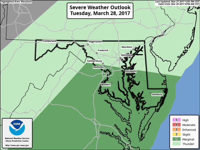
SPC currently has College Park and southern Maryland in a marginal risk for severe weather on Tuesday. (Via SPC)
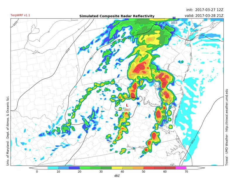
TerpWRF model showing the possibility of thunderstorms across the region around 5 p.m. Tuesday. (Via Trowal)
Elsewhere in the world:
The southern hemisphere has had a fairly quiet tropical weather season thus far, but a powerful category 4 cyclone “Debbie” is currently bearing down on northeastern Australia. It is projected to make landfall late Tuesday morning (Monday Night eastern U.S. time). Flooding and damaging winds are expected to rip through the region before it weakens over land.
