
Morning Update
Snow, sleet and freezing rain left a slushy and slippery mess on the roads through this morning! Several inches of heavy wet, snow are buried under layers of sleet and freezing rain. The storm will continue to track along the coast and produce more snow through the morning. Be careful on your walk to the bus stop. Roads are slick! Sleet/mix/mist continues to fall right now with steady snow falling in suburban areas. Between 10 am to noon today, there will be a changeover to another round of snow (with some wintry mix) across parts of the area. Strong northwest winds and gusts expected to pick up later today which could knock down power lines and already frozen tree limbs. Most likely snowfall amounts range from 3-4 inches across DC, 4-6 inches across Baltimore, and 8-12 inches for Northern/Western Maryland and parts of Virginia (see image below).
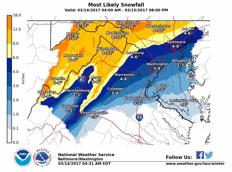
Updated Most Likely Snowfall Map issued by the National Weather Service Baltimore/Washington WFO
Do you have any storm reports? Send your photos to our Twitter or Facebook page!