
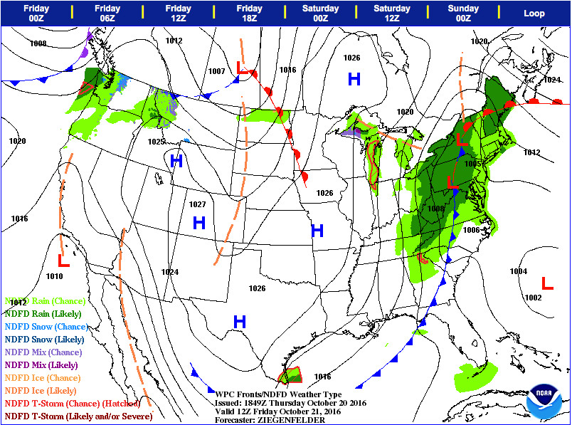
Weather Prediction Center projects a cold front to move into the region on Friday around 8 a.m. EDT (Photo Credit: WPC)
Forecast Overview
Relief is on the way following a sweltering week of record-breaking temperatures experienced across the Mid-Atlantic. Earlier this week, Washington Dulles International Airport achieved a 3-day high temperature record streak (Monday through Wednesday) after breaking past record high temperatures. Additionally, Baltimore-Washington International (BWI) exceeded record temperatures on Tuesday and Wednesday. However, a strong sweeping cold front will generate much colder/fall-like temperatures on Friday and Saturday. High temperatures will experience a bit of a roller coaster ride as they transition from 20 degrees above average to 10 degrees below average (average high temperature for October is 67°F). The decrease in temperatures will accompany widespread rain showers and cloudy conditions. The rest of the weekend will feature cool temperatures and brisk northerly wind breezes which could produce the first noticeable wind chills of the season.
Thursday (Night)
Mostly cloudy skies will lock in daytime heat and allow low temperatures to stay on the mild side as they subside into the mid-60s (the normal high for mid-October!). After midnight, an increasing chance for stray showers are expected to develop along with the potential for patchy fog. Light winds out of the south will provide a calm breeze around 5 to 10 mph.
Friday
As the cold front approaches from the northwest, widespread showers will occur across the forecast area during the early morning hours. Between 2 p.m. and 4 p.m., abundant rain showers will continue to migrate into the College Park vicinity. Less than a quarter of an inch rain is anticipated while increasing amounts are likely to occur west of the I-95 corridor. Noticeably cooler daytime temperatures will decrease throughout the day after reaching into the upper 60’s (east of the District) and low 50’s (north and west of the District). Winds will shift from a light southerly flow (5 to 10 mph) to a breezy northwest wind (15 to 20 mph).
Saturday and Beyond
As high pressure builds in behind the cold front, the weekend will finally consist of fall-like weather along with below-average chilly temperatures. On Saturday morning, leftover showers will pass over the area before cloud coverage decreases by the afternoon. High temperatures will climb to the mid-to-upper 50’s and low temperatures will range from the upper 30’s to low 40’s. On Sunday morning, the wind-chill temperature will dip towards the freezing mark (see image below). More specifically, cool overnight temperatures combined with blustery northeast winds (15-20 mph) will make it “feel” close to the freezing temperature (32°F). By Sunday afternoon, clear skies will prevail and temperatures will peak towards the low 60’s. Next week, dry and cool air will result from the combination of high pressure and a seasonable autumn air mass.
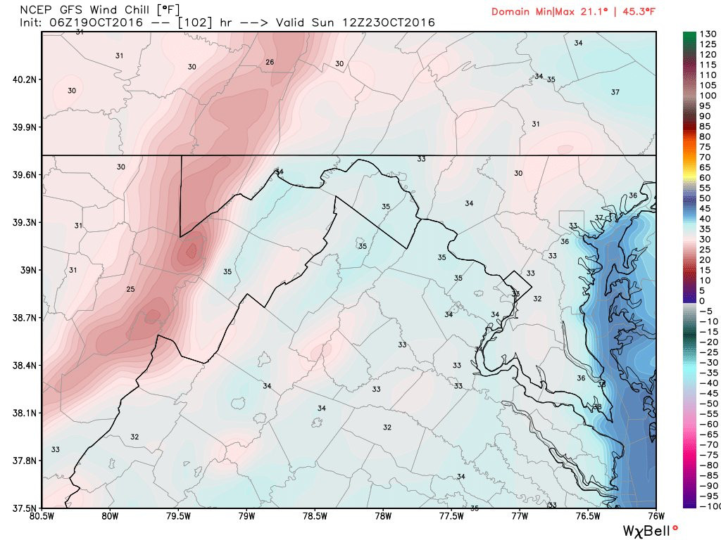
GFS model shows the first noticeable wind chills of the season could be felt early Sunday morning (Photo Credit: WxBell)