
Welcome back from the Weekend, Terps! The workweek starts considerably warmer than anything we’ve seen so far this spring, alongside some insight into why we’ll be seeing some hotter weather later in the week.
Today:
Our week starts relatively pleasantly, but on the warmer and gustier side compared to last week. Expect partly cloudy skies with occasional patches of sunlight. Temperatures at sunrise start in the low to mid 60s and rise into the low 80s by lunchtime. Winds from the southwest blow around 10-15 mph throughout the day, alongside gusts as high as 25 mph until sunset. Some chances for scattered rain in the early afternoon, but any rain is not expected to be significant. It’s important to note that, considering the higher winds today, pollen, especially tree pollen, is anticipated to be a problem for anyone with pollen allergies.
Tonight:
Temperatures after sundown gradually fall and remain in the low 70s/upper 60s by midnight. Winds remain from the southwest but die down to a calm breeze around 5 mph in the evening and night.
Tomorrow:
Calmer winds, sunny skies, and warming temperatures begin on Tuesday. A wind remains out of the southwest, and a 5-10 mph breeze blows throughout the day. Temperatures at sunrise start in the 60s, then quickly rise to the low 80s by noon and reach a high in the upper 80s by the late afternoon. Skies are expected to remain mostly sunny, with some occasional clouds throughout the day.
Looking Ahead:
The College Park area is gearing up for some hot weather later in the week. Wednesday could see the hottest temperatures this week, with daytime high temperatures in the low 90s. Thursday is expected to see similar temperatures in the low 90s, but with more cloud cover. Temperatures in the upper 80s are expected as we enter the weekend. As of now, no notable rain or storms are expected during the weekday; the air is expected to remain relatively dry, and the skies should remain sunny for the remainder of the week.
Discussion:
The College Park area is anticipated to be hit with a wave of warmer weather this week. This week, especially in the latter part of the week, will likely see the first 90-degree day of the season. A strong, upper-level ridge will set the stage for dry air and limited convection to will give us the sunny skies and high temperatures.
On Monday, a warmer mass of air passes over our area and brings warmer air to the lower levels of the atmosphere where we reside. The warm front that passes will also bring the high winds in the process. As you move up into the middle of the atmosphere, the air becomes much drier, which limits the low and mid cloud formation. Without these clouds, sunlight is able to more easily reach the surface and heat up our temperatures. There is a chance for some rain from noon to 4 p.m., but isolated spots for convection make this uncertain for our area; the chance of seeing afternoon rain on Monday is relatively low. If rain is able to form over our area, the resulting rainfall should not be anything that would cause any significant impacts. The same pattern is relatively the same for Tuesday’s weather. Winds die down, which could contribute to the slightly higher temperatures. There is a very small chance for isolated showers after 3 p.m., which could impact how warm our temperatures could become. Overall, rain is not a major concern given how spotty the rain chances are.
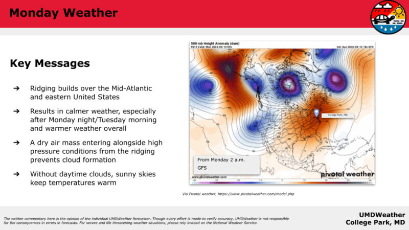
CONUS map showing 500mb height anomaly. Red colors indicate high heights. Via https://www.pivotalweather.com/model.php
The temperatures that we could see later this week could even have some potential to break records!
As of writing this article (12 a.m. on 4/13), the high for Wednesday is expected to be in the low 90s, around 90-92 degrees. The current record is 95 degrees Fahrenheit in April for the Washington D.C. area, which occurred most recently in 2002.
The Washington D.C. area likely, as of publishing this article, won’t break the 95-degree record. To break this temperature record, it will likely depend on many contributing weather factors for Wednesday. If the skies are sunny for most of the day, there is a good chance the ground could heat up sufficiently, allowing temperatures to rise and approach these record-breaking levels. So long as cloud cover is scarce on these days, our area could see slightly higher temperatures. Make sure to pay attention and check out any of the most recent weather updates.
Regardless, it will be warm this week, so make preparations if you plan to be outside!
- Writer: Frances Schoenly