
Expect rainy conditions to continue, as we have a chance of seeing rain tonight into tomorrow morning. Temperatures are expected to warm over the weekend.
Today:
Morning temperatures start in the mid-40s before gradually increasing into a high temperature in the lower 50s. As we move into the early evening, temperatures return to the mid-40s range. There is a chance for some morning drizzle, along with evening showers starting after 3 p.m. Winds will be light and variable.
Tonight:
Temperatures overnight will remain in the mid-40s, with light and variable winds and fog. Some areas may receive a drizzle overnight as well.
Tomorrow (Thursday):
Tomorrow, morning temperatures start in the mid-40s and should noticeably increase into the upper 50s by the afternoon. Early evening will see temperatures fall into the lower 50s. Winds will be light and variable. Unfortunately, we once again may see a drizzle in the morning, and the rain may make a comeback for the evening, so don’t put away those umbrellas just yet!
Looking Ahead:
The rain will finally give out on Friday, making way for a beautiful weekend of partly cloudy skies and temperatures in the 70s!
Discussion:
Models have been showing since this past weekend that temperatures are going to be noticeably warmer than what we have been feeling for the past few weeks. While original model runs predicted 70 degree weather by Thursday, current model runs suggest that we will start to see these warmer temperatures in the weekend. The actual timing of this much-awaited warmer weather is dependent on the overall weather pattern that the country is seeing. So far this week, cold air damming in our region has been occurring, where high pressure to the north feeds and traps cold air into the Mid-Atlantic region. Thus, temperatures have been feeling on the colder side. As we approach the end of the week, the high pressure system moves off the coast and warm air is able to make its way up into our area.
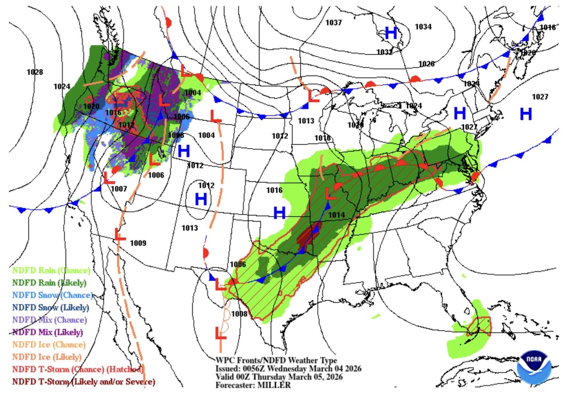
Via wpc.ncep.noaa.gov
Here is the high-pressure system moving off the coast Wednesday evening. Below, check out how by Thursday afternoon, warmer air from the south moves into our area!
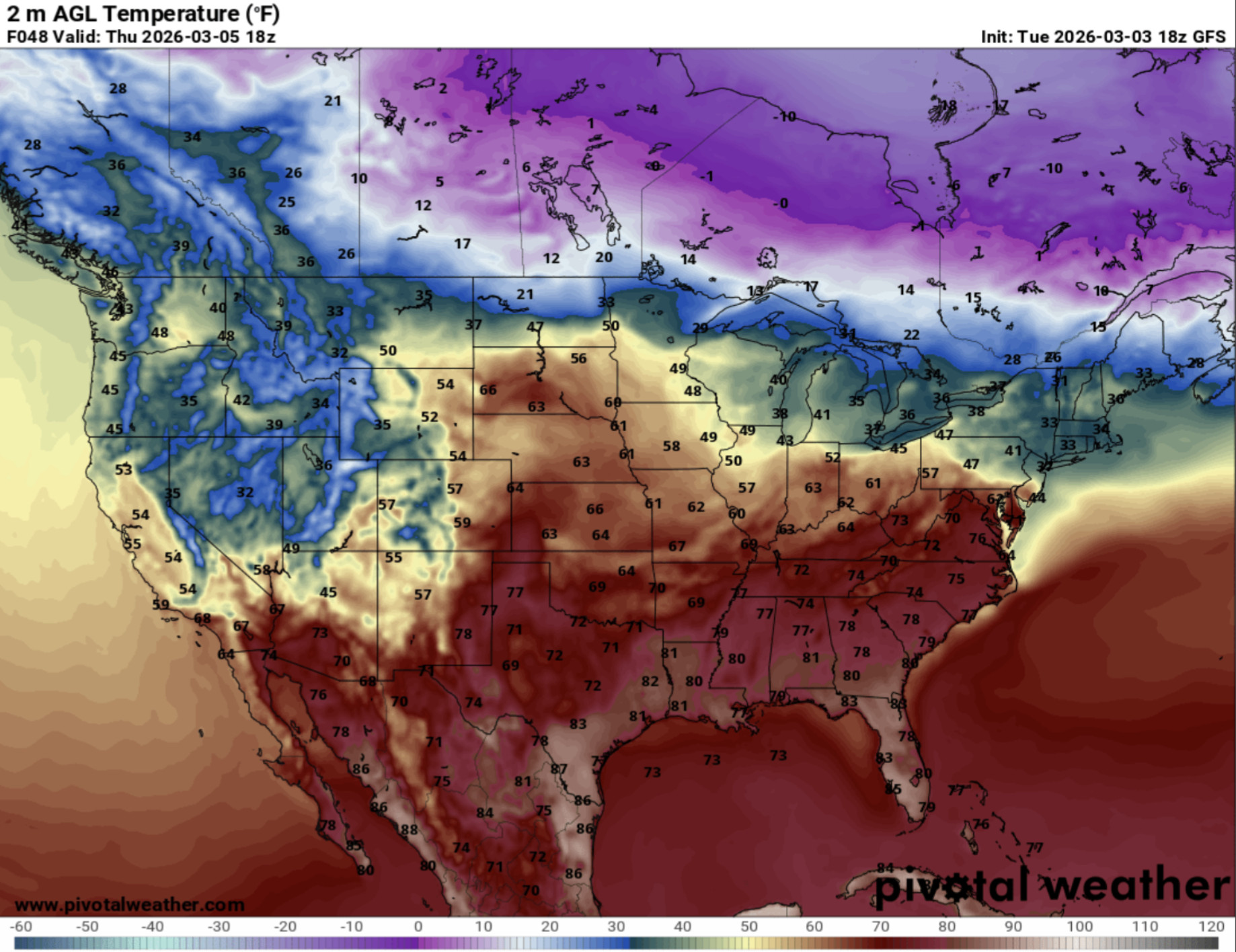
via www.pivotalweather.com
The red coloring that we see in our area represents temperatures in the 70s.
That’s all for today. Have a great day, Terps!
- Writer: Anjali Vidyasagar
- Editor: Morgan Peterson
Featured image via Jake Kaufman