
Today:
This morning, temperatures will start in the low 30s; however, by the early afternoon, temperatures are expected to reach the lower 50s, with lots of sunshine! Winds will also be 5 to10 mph throughout the day. As we head into the evening, some clouds will roll into the region, and temperatures will decrease into the mid 40s. Expect light and variable winds.
Tonight:
Temperatures will dip down to the low 30s, with mostly cloudy skies along with light and variable winds.
Tomorrow (Sunday):
The day will start off cloudy, with morning temperatures between the mid and high 30s. By the afternoon, temperatures will rise to a high in the mid 40s. A storm system is also moving into our area, so some rain could be expected beginning in the afternoon. However, winds will continue to stay light and variable throughout the day. Heading into the overnight hours, there is a slight possibility of this rain continuing.
Looking Ahead:
As we head into next week, daytime highs are expected to be around or in the 50s, with nightly lows in the lower 40s and upper 30s. Throughout the week, winds are likely to stay below 15 mph. Additionally, these warmer temperatures will continue to melt the snow and ice, so look out for puddles, mud, and it potentially even sliding off buildings.
Discussion:
So, why are temperatures rising?
It’s not because of all the love in the air. A ridge, which corresponds with high pressure aloft, is moving into our area, which you can see with the warmer colors on the map. This is the main driver of these warmer temperatures that we will be seeing within the next week.
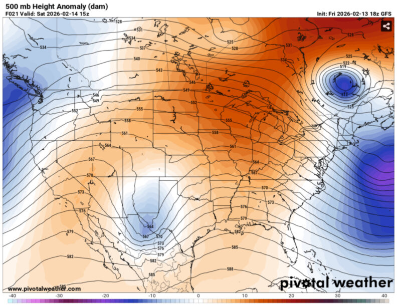
Via www.pivotalweather.com
- Writer: Naomi Feldman
- Editor: Frances Schoenly