
Good evening, Terps! We’re here to bring you a late-night forecast about the possibilities of snow tomorrow.
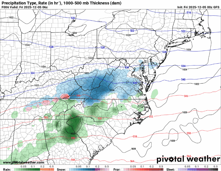
To get to the point, it will be cold tomorrow, and there is snow on the way. We’re predicting around an inch of snow to fall around 4 a.m., which will impact morning commutes.
Expect below-freezing temperatures in the early to late morning. The cold temperatures should make the ground cold enough for any snow to stick, especially for untreated surfaces. There is also a possibility for accumulated snow to create icy conditions on roadways. The snow should arrive and begin to fall during commute hours, so take extra care if you are planning on commuting to campus tomorrow morning.
Via www.pivotalweather.com
The GIF above shows the arrival of the snow in College Park and loops from 1 a.m. to 4 p.m. on Friday. The snow is on its way; snow has currently been spotted (as of 10:20 p.m. Thursday) in southern and central Virginia along the I-81 corridor.
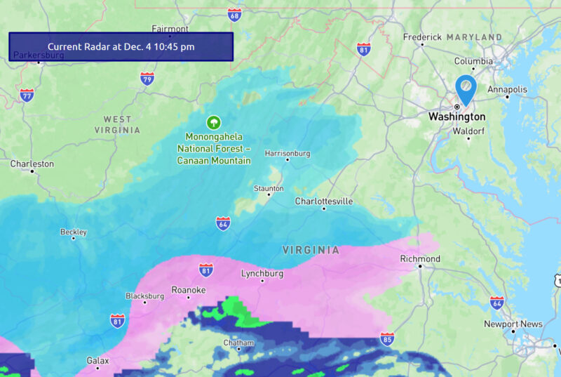
Via https://www.weatherbug.com/maps?layerId=radar¢er=38.9953,-76.9383,6.407305050698431
Stay tuned, stay warm, and stay safe tomorrow! We will be sure to keep you all updated on Instagram at @umdweather.
Discussion:
While the low-pressure system associated with this system is further south (in the Carolinas), we are under the left exit region of a jet streak (a localized area of faster-moving winds) in the Mid-Atlantic/Northeast. The left exit regions of jet streaks are typically associated with upwards motion, and combined with moist air brought by the system, can lead to cloud and precipitation formation. Our position within the jet streak, along with the faster-moving nature of this system into the cold air mass, enhances the northward shift of this snow into our area observed in updated forecasts. The change in this setup has since allowed the snow track to shift northward.
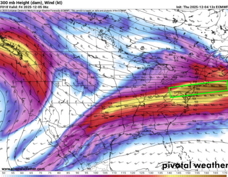
Via www.pivotalweather.com
The above map depicts upper-level winds in the atmosphere early tomorrow morning. The right exit jet streak region, which we will be under, is indicated by the green box.
- Writers: Anjali Vidyasagar and Frances Schoenly
Featured image via www.weatherbug.com