
Today:
Morning temperatures are starting off on the cooler side, ranging from the lower to mid-30s. Afternoon temperatures will reach a high of around 50 degrees. Following this, evening temperatures will dip back into the lower 40s. Cloud cover will increase throughout the day, resulting in some light rain later this evening. Expect light and variable winds.
Tonight:
Overnight, temperatures will hover around the low 40s range. The rain that will start this evening will continue into the night.. Like the day, winds will be light and variable.
Wednesday:
Nighttime temperatures in the lower 40s will continue into the morning. During the afternoon, temperatures will warm into the low 50s. Evening temperatures drop back into the mid-40s. Once again, winds will be light and variable, and cloudy skies will persist throughout the day.
Looking Ahead:
Temperatures for the rest of the week will continue to gradually warm. Cloudy skies will stay with us for the remainder of the week, as well. While we will not be experiencing windier conditions like we saw yesterday, take advantage of this warmer weather if you can!
Discussion:
Yesterday, our weather story was still ruled by an area of high pressure, causing subsidence (sinking air) and stable weather conditions.
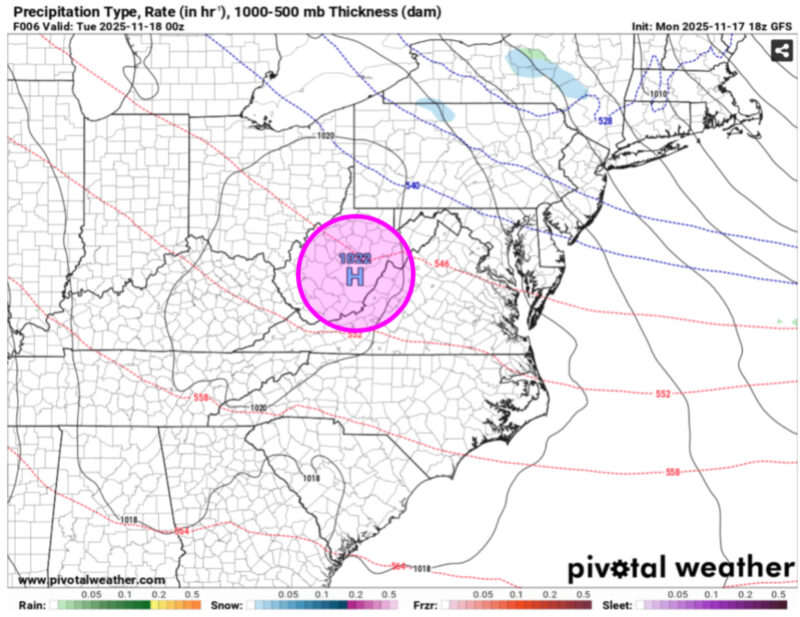
Via www.pivotalweather.com
Pictured is the high-pressure system (pink circle) that was in our area yesterday evening. The red and blue dotted lines are indicative of atmospheric thickness lines, which can be used to represent temperatures. When plotted with isobars, which are lines of constant pressure (black solid lines), the alignment of thickness lines relative to the isobars can represent temperature advection (the process of warm/cool air moving into/out of the area). In this case, isobars are plotted relatively perpendicular to the thickness lines, which indicates the presence of wind that moves thickness/temperatures. Red dotted lines depict warm air advection, or warm air moving into a region of cooler air. Blue dotted lines depict cold air advection, or cold air moving into a region of warmer air. In this weather map, we are seeing the transition from cold air advection to warm air advection.
The weather map below features the weak low-pressure system (purple circle) trekking through the region, which is responsible for the dreary weather that we will be seeing today. The high-pressure system from yesterday moves off the coast, making way for the low-pressure system that will bring rain into our area tonight. Additionally, we are seeing warm air advection, meaning that today’s temperatures are warmer than yesterday’s.
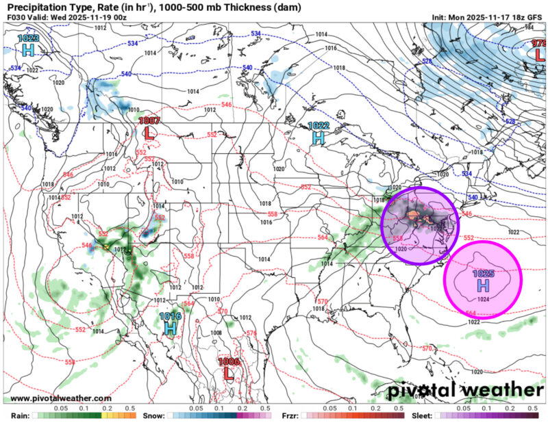
Via www.pivotalweather.com
That’s all for today. Have a great day, Terps!
- Writer: Anjali Vidyasagar
- Editor: Frances Schoenly
Featured image via Jake Kaufman