
After a brief website issue, the UMD Weather Writers are back and writing again! Here’s your weather for the start of the week.
Today:
The rainy weather from yesterday will transition into nicer, sunnier weather today. Morning temperatures will range in the 50s before rising to highs in the mid-60s by the afternoon. Expect breezier conditions throughout the day, with winds ranging in the 10 to 15 mph range, with some stronger gusts possible.
Tonight:
As the sun sets, conditions will calm and skies will remain clear. Temperatures are expected to drop into the lower 50s, and winds become calm by midnight. Early morning temperatures drop into the low 40s.
Tomorrow:
Anticipate Tuesday’s weather to feel relatively similar to Monday’s weather. Temperatures will be slightly warmer, and breezes will be slightly calmer. Temperatures will be relatively chilly from overnight as the sun rises, but will rise to a high in the lower 70s by mid-afternoon hours. Anticipate nighttime temperatures in the 60s and into the 50s with some chances for nighttime showers after sunset.
Looking Ahead:
Wednesday marks the beginning of calm and sunny fall weather for the remainder of the workweek. From Wednesday onwards, expect daytime temperatures in the low to mid-60s and chilly nights with low temperatures dipping into the low to mid-40s. Some breezier conditions are expected for Wednesday and Thursday, but expect an overall pleasant end to our week!
Discussion:
The College Park area will be in a bit of a transitional situation following the passage of the low-pressure system setup that brought us the high winds and rain last night.
A high-pressure system builds up around our area to our south today and sets up a relatively notable pressure gradient between the lower pressures to our north. This setup will be the main culprit behind the windier conditions and gusts on Monday.
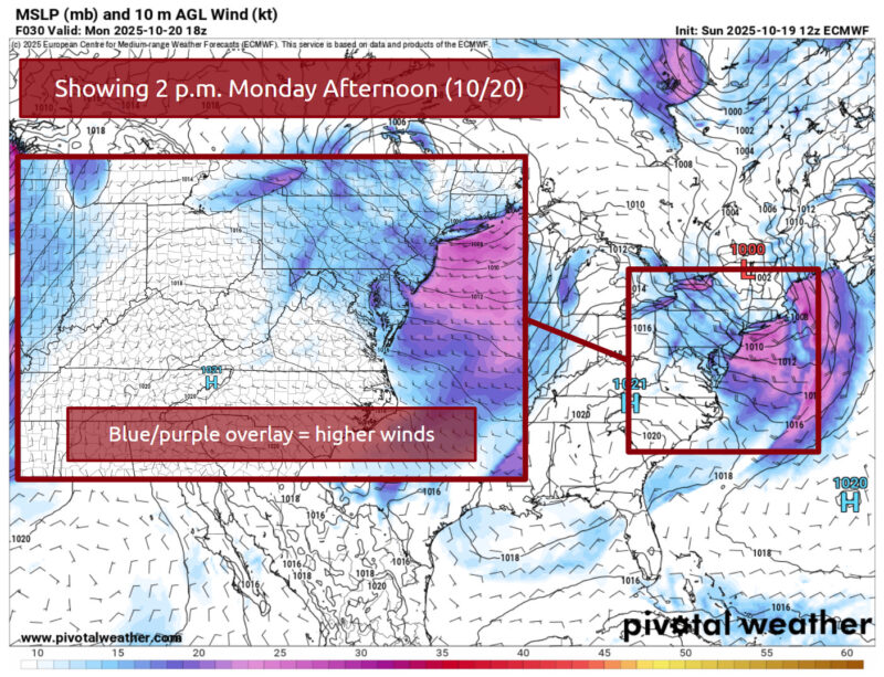
Via https://home.pivotalweather.com/
Another low-pressure system is currently brewing in the central USA/central-southern Canada area. This system will travel eastward and bring another cold front over our area on Tuesday afternoon and evening. With the passage of this front alongside some lingering moisture, there is a small chance of scattered showers in the nighttime, but it should not pose a substantial issue.
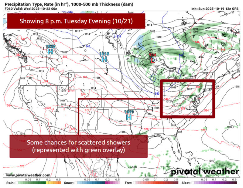
Via https://home.pivotalweather.com/
Coupled with the passage of this front, we remain nestled within colder air up until early Saturday morning. The jet stream’s setup from Wednesday into the end of the week should help bring some colder, northern air into the Mid-Atlantic.
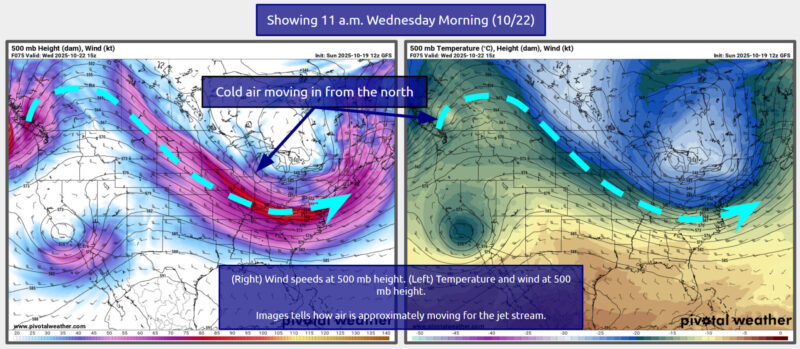
Via https://home.pivotalweather.com/
That’s all for now. College Park has some nice fall weather in sight, so be sure to get outside and enjoy the sunshine and the pretty fall foliage. Thanks for tuning in.
- Author: Frances Schoenly