
Today:
Expect beautiful conditions throughout the day, with partly cloudy skies and winds ranging from 5 to 10 mph. Morning temperatures will start in the high 30s before quickly warming up to the high 50s to low 60s by the afternoon. In the early evening, temperatures will dip back into the mid to lower 50s. Today is a great day to soak up some sunshine and fresh air!
Tonight:
Temperatures will be a little chilly compared to the daytime warmth, with low temperatures in the mid-30s. Winds will be light and variable, with clear conditions throughout the night.
Wednesday:
The day will start off in the high 30s, with temperatures climbing into the low 60s by the late afternoon. Expect clear conditions with light and variable winds.
Looking Ahead:
This unseasonably warm weather will continue throughout the week, before temperatures drop back to what we would expect for this time of year on Friday. We will likely be seeing some rain on Thursday, but once it clears out, we can expect the dry weather to resume.
Discussion:
Why is it so warm all of a sudden!? A high pressure system will move into our area on Wednesday, leading to rising temperatures throughout the week. As air sinks and moves closer to the surface, it gets warmer, resulting in a temperature increase. Additionally, a shift in wind direction from the northwest to the south during the middle of the week allows for warm advection to take place. This occurs when wind comes from a warmer region, in our case the southern U.S., and brings warmer temperatures with it.
These warmer temperatures won’t last forever, as a low pressure system and cold front arrive later in the week on Thursday, bringing cooler air back into the area. Cold fronts, as the name suggests, bring cold temperatures, while low pressure systems are also generally associated with a drop in temperature, as rising air in the system cools as it gains altitude. For now, try to enjoy this amazing weather, Terps!
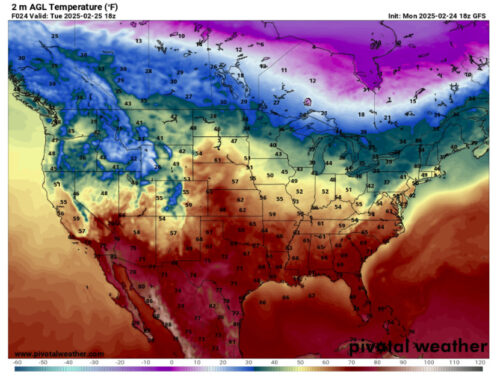
Via www.pivotalweather.com
This is the temperature map for today. Notice the streaks of orange, indicating warmer temperatures, reaching our area.
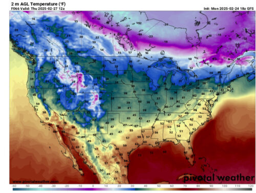
Via www.pivotalweather.com
This is the temperature map for Thursday, around the time when we are expecting rain in our area. Notice that temperatures are not as warm as they were in the previous map. This cooling is due to the presence of the approaching low pressure system and cold front. Once the front moves through, it will bring back colder temperatures and the end of our unseasonably warm stretch!
That’s all for today, have a great day Terps!
– Writer: Anjali Vidyasagar
– Editor: Madison Magaha
Featured image via Anjali Vidyasagar