
Today:
The cold temperatures we have been experiencing these past two days will continue to persist today, with morning temperatures in the high 10s to low 20s. Afternoon temperatures do not break the 30 degree threshold and will range between the mid to high 20s. Winds will stay light, with speeds ranging between 5-10 mph. Despite the ever-changing reports about a potential winter storm, we most likely will not be seeing any winter precipitation. Looks like it will be another cold, dry day at College Park!
Tonight:
This evening will look similar to this morning: cloudy and cold. Temperatures will dip back down into the low 20s to high 10s, with light and variable winds throughout the evening.
Thursday:
Expect cold, cloudy, and slightly windier conditions for your Thursday, with temperatures starting off in the low 20s and peaking in the afternoon in the high 20s. The general wind range will be anywhere between 5 to 15 mph, with potential gusts up to 20 mph.
Looking Ahead:
We will finally be warming up for our Friday and into the weekend, with temperatures getting into the upper 30s to mid 40s. The clouds from yesterday will move out of our area.
Discussion:
What happened to the snow!? Although there was much variation in previous days regarding snow totals in our area, the system ended up staying to the south of us. The snow portion of the low pressure system is hitting areas from the tip of Maryland’s Eastern Shore to North Carolina. The effects from the high pressure system from Canada that dipped down into the northern parts of the U.S. earlier this week were the main snow deterrent for us. The persistent high pressure equates to more sinking of air, which prevents cloud formation (and therefore snow). This explains why we do see clouds from the low pressure system, yet no precipitation as the high blocks further saturation. Combined with the fact that the warmer, moist streak of air brought by the low pressure system misses the area of cold air in our region, the atmospheric conditions limit chances for snow. Similarly, moving into the weekend, we will see sunnier conditions, which is explained by the high pressure zone moving from the northern U.S. into our area come Saturday.
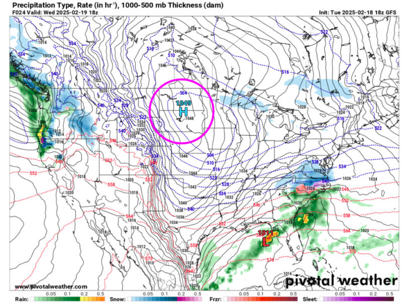
Here is the Canadian high pressure system’s position as of today, as indicated by the pink circle. We just missed the snow!
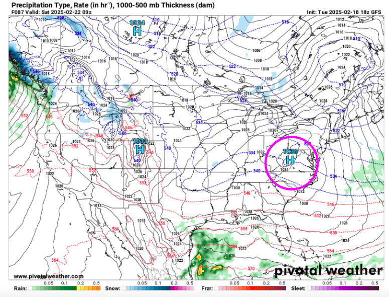
This is the same high pressure system on Saturday now over the DMV area.
That’s all for today! Have a great day, Terps!
– Anjali Vidyasagar