Today:
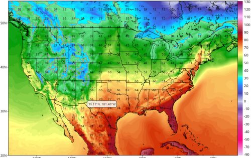
Expect much higher temperatures today than the last couple days; highs will be reaching nearly 80 degrees F. We’ll get some of that typical Maryland humidity today, with relative humidity levels hovering around 70% in the midmorning. These summer-ish conditions are due to a tornado-spawning system dissipating in the South and pushing warm, moist air in our direction. As such, winds will also be strong, with gusts likely to top out around 25 mph.

GFS 2m Temperature (F). You can see the warm air seeping northward in the temperature map above (via Tropical Tidbits).
Tomorrrow (Saturday):
More of the same, with highs in the mid seventies and lows in the mid fifties. Expect little to no cloud cover throughout the day, and winds will remain light and variable.
A Look Ahead:
This brief spell of hot weather slips away, as next week gives us another downward spiral into colder temperatures. The low for next week is a measly 29 degrees, and the lowest high tops out around 49 degrees F on Friday.
featured image via pixabay.com
