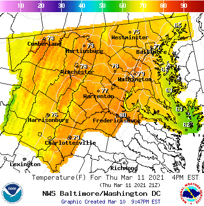
Today:
With only two days before the start of spring break weekend, let’s hope that this beautiful weather continues into the break that we all need. This morning we start off with mostly sunny skies and by 9 a.m temperatures will reach the mid 50s. Wind speeds of about 11 mph blowing from the southwest in the morning will increase to about 17 mph in the afternoon with gusts as high as 28 mph in some areas. By the afternoon, temperatures will reach a high of 75 F around 3 PM. This will be the highest of the week so be sure to enjoy it.

Tonight:
By nightfall, sky cover will remain partially cloudy with a low of 63 F by 9 p.m. Winds will drop back down to around 11 mph before the start of a new day.
Tomorrow (Friday):
Tomorrow, mostly cloudy skies will cover the campus throughout the day with the addition of a 50% chance of rain between 10 am and 3 pm in the afternoon. Temperatures will still be warm but not as high as the day before. By 9 am temperatures will be about 60 F and increase to a high of 69 F in the afternoon before coming down to a low in the high 50s by the evening. Winds ranging between 6 to 10 mph will persist throughout the day.
A Look Ahead:
As we come to Spring Break weekend, temperatures will drop, only reaching a high of 53 F on Saturday. Mostly sunny skies will aid in alleviating the cold before the temperatures drop down in the low 40s in the evening. Like Saturday, Sunday will experience much of the same temperatures with a high around 55 F in the afternoon and a low in the mid 40s.
Featured image via Pixabay.com
