
Today: Mostly cloudy conditions will persist into much of the day Wednesday. A stray sprinkle cannot be ruled out, though the chance of rain will slightly increase as we get into the late evening. High humidity will stick with us throughout a mild day overall. Winds will remain light out of the west between 3-5 mph. The high will be 66 degrees.
Tonight: A cold front is expected to stall in our area starting this evening. Along this stalled front, showers will develop in conjunction with the remnants of what is currently Hurricane Zeta. These showers will begin to move into the region late overnight, mainly after 3 am. Winds will still remain light, shifting to the east as the night goes on. The low will remain mild at 59 degrees.
Thursday: The stalled front in our area will funnel the remnants of Zeta into the region from the southwest. In doing so, Zeta will merge with a strong upper level low coming in from the mid-west. This combined system will be a big rain maker for the entire day Thursday, dropping as much as 2-3 inches of rain in the area by nightfall. Localized flooding is possible although the threat is relatively low. Breezy conditions are expected as Zeta approaches the region. The high will be 65 degrees.
Thursday Night: Showers will persist for much of the night as what’s left of Zeta makes its way out of the region and moves out over the Atlantic. Temperatures will be dropping steadily into the low 50s, high 40s as the night goes on. Winds will also increase out of the northerly direction.
A Look Ahead: Behind the system will be a potent blast of cold air that will make for a cool, clear, and windy Halloweekend with highs in the 50s and lows possibly getting down into the 30s. With that being said, make sure to dress accordingly if you go out for Halloween.
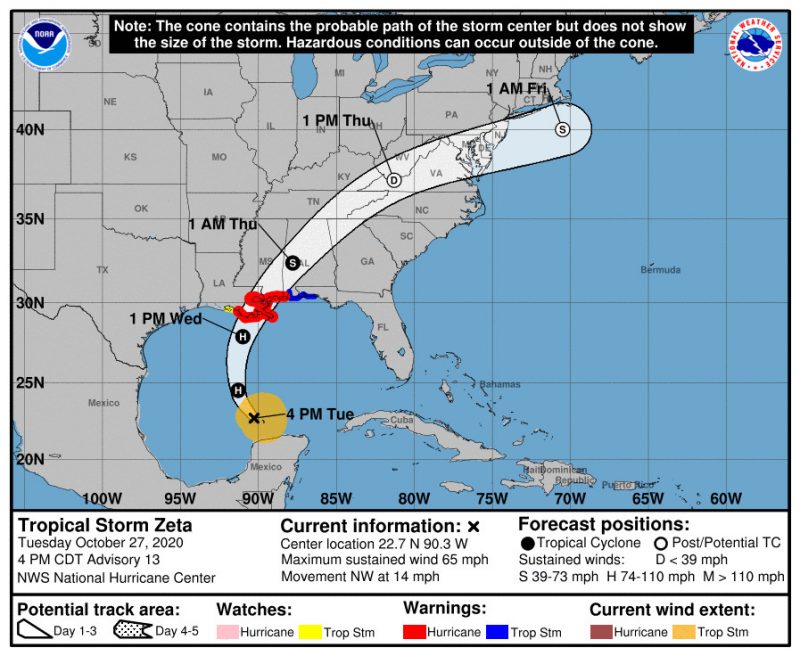
(Image via NHC)
Featured image via Pixabay.com