
Today:
It will be a beautiful Fall day, that makes you wish you had to leave your house to go to campus. The high pressure over the east coast will assure we have a mostly clear sky, and temperatures will reach the low to mid 70s before the end of the afternoon. Winds will be calm at first, but they will eventually reach 5 to 8 mph coming from the southwest.
Tonight:
It won’t be as cold tonight as it was Monday night, with a low of around 55 degrees F. The southwesterly wind will continue throughout the night. Tonight will be a perfect, clear night to see the moon, as the high pressure in our region should hold.
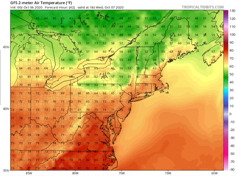
Tomorrow (Wednesday):
Expect more of the same on Wednesday, with clear skies, and no sign of rain. It may be noticeably warmer with a high of around 80 degrees F. This can be attributed to the wind, continuing to carry warm air from the south and southwest. The wind may even become strong at times, with gusts up to 24 mph. However, the unseasonable warmth that we may see tomorrow will not continue for long.
A Look Ahead:
After Wednesday, temperatures will fall back into their normal ranges, sometimes even dropping below average highs and lows for this time of year. Most notably, the low on Thursday night is expected to be around 45 degrees F. No rain is expected until at least Saturday, where we may see the remnants of Hurricane Delta. There will be plenty of time to enjoy the crisp, clear Fall weather before then!
Other Weather News:
Washington’s main weather radar will be down until October 16th, impacting the tracking of thunderstorms and heavy rainfall.
featured image via pixabay.com