
Today:
Mostly sunny skies will prevail once again and temperatures will warm quickly after a chilly start. High will reach the upper 60s to near 70 degrees, just a few degrees shy of normal. Winds will be light out of the southeast around 5 mph.
Tonight:
Increasing cloud cover and the chance for some rain showers after midnight will keep temperatures from cooling off as much as last night. Low temperatures will be in the low 50s and there is a 50% chance for rain.
Tomorrow (Monday):
Despite the chance for a few morning showers, mostly sunny skies will dominate by the afternoon, making for a beautiful start to the week. Temperatures will top out in the mid to upper 60s and there is a 30% chance for a morning rain shower. Winds will be out of the northwest at 5 mph.
A Look Ahead:
Tuesday begins a warming trend as temperatures return to normal in the low 70s under sunny skies. The 70s and sunshine stick with us before another drop in temperatures is expected for the end of the week.
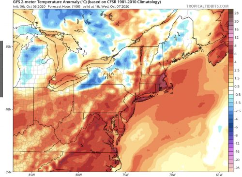
Temperatures Wednesday will rebound to about 5 degrees above normal. (Image via tropicaltidbits.com)
Other Weather News:
Washington’s main weather radar will be down until October 16th, impacting the tracking of thunderstorms and heavy rainfall.
featured image via pixabay.com