Today:
While Labor Day may have passed, summer weather isn’t ready to let go quite yet. This morning starts off in the low 70’s, but reaches 80 F by noon. Cloud cover is minimal throughout the day, and no precipitation is expected. Winds are light and variable. Mother nature isn’t giving us a break from the heat or sunshine quite yet, so make sure to stay hydrated and well protected from the sun while walking to classes!
Tonight:
Temperatures drop back to the low 70’s throughout the night and even lowering to the high 60’s in the early morning tomorrow. Chance of precipitation is very low, so don’t worry about bringing your umbrella to class yet! Cloud cover increases slightly, but overall a clear night is expected. Head out to McKeldin mall for some stargazing and look for the waxing crescent moon!
Looking Forward:
Tomorrow afternoon cloud cover picks up and temperatures reach the low 90’s. Some scattered thunderstorms may occur as well. The rest of the week looks cooler, with some rain expected on Friday. A sunny, warm weekend looks ahead, making the end of a perfectly shortened week!
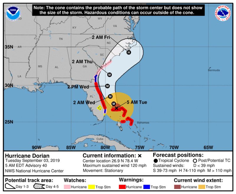
Hurricane Dorian:
Currently at a category 3 hurricane, the stationary storm over the Bahamas has already caused extensive damage. Florida, Georgia, and the Carolinas are preparing for the impending approach of Dorian. Walt Disney World, located in Orlando, FL, is known for staying open during inclement weather, is planning on closing various theme parks early on Tuesday and relocating guests at their campgrounds to hotels as a precaution.