
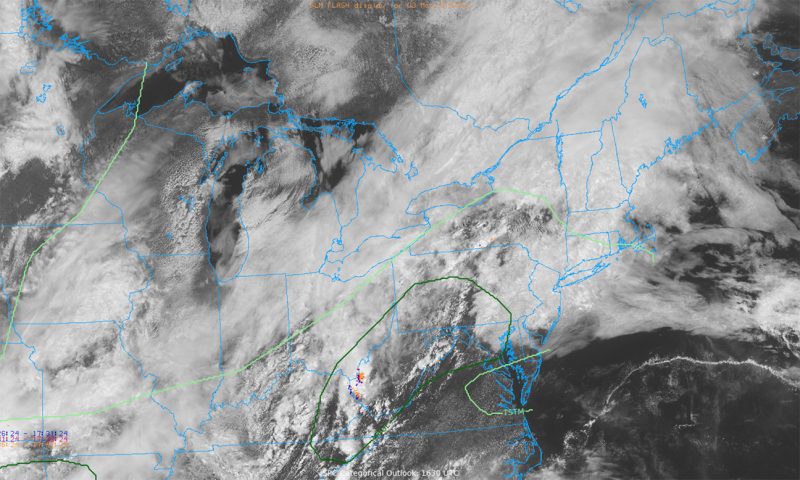
Get ready for the chance of another frenzy of storms to fire off this evening, crashing your Friday night plans, as humidity and heat steadily build up throughout the day. The rain will linger longer than usual due to a stationary front draped across the region and damaging winds could be a concern. Read on to find out how to plan ahead for your Art Attack, your bar crawl, or your end-of-the-school year plans.
Tonight:
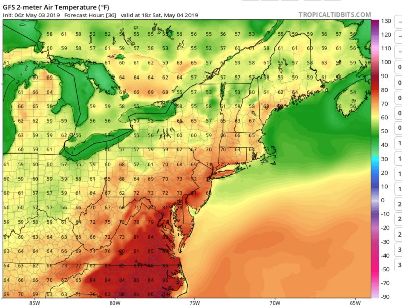
Temperatures will peak in the upper 70s to 80s this evening, and southerly winds funnel in plenty of moisture to maintain the mugginess. We may get some promising peeks of sunshine before the storm clouds rumble in again through tonight. A surface low pressure in conjunction with some upper-level and daytime instability will be the main drivers of any storms that strike the area. Half an inch to an inch averaged across the area could splash the streets as storm clouds are likely to stall once spawned by the stationary front. We are in a marginal risk area for high winds and hail if storms do strike, so make sure to keep an eye to the sky and to the radar as the evening progresses.
Tomorrow (Saturday):
Higher pressure will build Saturday morning and shove the surface low off-shore, allowing for a slight reprieve from stormy weather. However, cloudier to overcast skies will dominate, but humidity and highs in the 80s will keep temperatures toasty. Winds will have shifted from southerly to northerly around 5 mph. However, by afternoon, storms from afternoon instability are likely to initiate once again. This weekend’s weather is sure to keep us on our toes.
Featured image via the author.