With a thick layer of clouds covering much of the region today, we were able to get a reprieve from some of the 80 degree days we received about once each week for most of April. The gray blanket overhead helped keep some of the sun’s energy from reaching the ground, which kept things in the mid 60s for much of the day, with a high of just 70 degrees. Winds were quiet for the most part, peaking at around 7 mph during the day. Fortunately we didn’t receive any rain today, thanks to the presence of a stationary front parked overhead. This could change however, as it seems the warmer air mass to our south finally won over and its passage through the region could bring showers later today.
Tonight (Wednesday):
Looking into this evening, it is likely the skies will remain mostly cloudy with the benefit of keeping our daytime heat in at the surface. This should keep temperatures very similar to during the day, with a low of just 62 expected tonight. Winds are expected to remain just as quiet as during the day, and remaining around 7 mph. Of course, with the passage of the warm front however, there is about a 30% chance we could see some rain late tonight, but any showers that develop should be isolated and no thunderstorms are expected.
Tomorrow (Thursday):
Tomorrow, we can expect the possibility of rain, with mostly clear skies during the day and a high of near 87 degrees. I’d make sure to be ready for the heat, or else you’re going to find yourself waiting for the cool rain most of the day. There will also be around a 50% chance of rain and possibly minor thunderstorms during the day and evening. Should any precipitation develop, we can expect it most likely after 2pm.
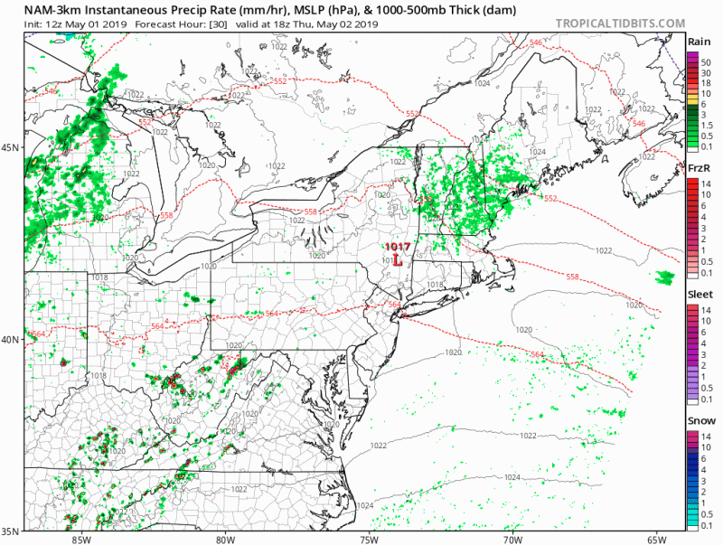
The latest mesoscale model runs appear to indicate showers running through the district around 4 or 5 p.m., with most of northern Maryland seeming to remain dry. Southern Maryland and possibly DC will likely be the region most likely to experience any thunderstorms should they develop.
Given the lack of serious cloud cover during the day to inhibit warming of the surface, we could see some severe thunderstorms in the district and to the south. Should any develop, isolated wind gusts and hail will be the primary concerns. For anyone commuting tomorrow evening, you’ll want to check the forecast again around 12 p.m. to get a more solid idea of when and where these storms build up.

Latest 12z NAM run depicts isolated showers in the DC area before multi cellular thunderstorms develop and race down into Southern Maryland. Image Courtesy of Tropical Tidbits
The Week Ahead:
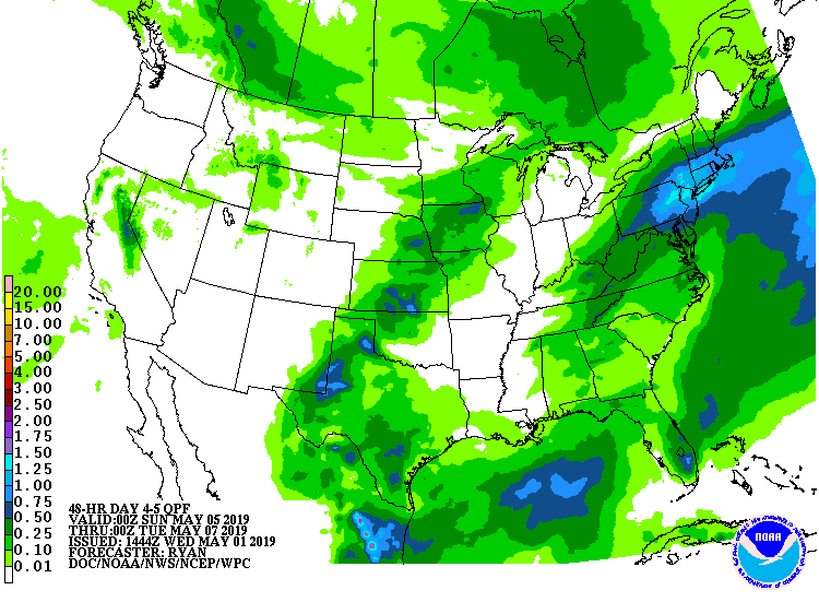
Looking into the week ahead, there will be a chance for showers for the next several days all the way into Sunday. Probabilities for rain range from about 30 to 50%, as their is still some uncertainty as to how far north an expected low pressure system will move relative to the region. On Saturday however, models are in good agreement that will see a low move directly overhead, and thus are chances for rain that day are about 70%. It would be a good idea to have a jacket ready the next few days and an umbrella for Saturday, as it may well rain for most of the day.

