
We keep riding that wave of low pressure to deal us some pretty messy weather as we wrap up the workweek and head into the weekend. During midterms, it can all feel like a slog, right? That’s what we’ll be seeing this evening and into tomorrow at least as we play with that magic line of snow, sleet and rain. However, while the clouds stick around tomorrow, the rain will be spottier and not as persistent as this evening.
Tonight:
Be extra careful driving this evening as the moist air intermingles with the just-above freezing temperatures to make for a foggy Friday evening. A small disturbance creeping through will keep rain trickling through the night so make sure your rain jacket and umbrella trail along to any Friday night plans, especially if you plan on being out late. Northeast winds could make temperatures feel even chiller than the low in the mid-thirties, but they’ll remain light overall in the 7 mph range.
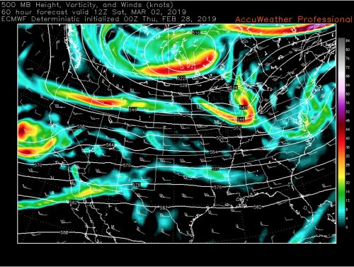
The small disturbance that creeps through tonight and causes patches of rain (via ECMWF).
Tomorrow (Saturday):
Most of the rain should clear out by early Saturday morning as a coastal low-pressure system tracks offshore and sweeps most of the soggy mess with it. Saturday will still be most likely overcast but a few breaks in the clouds could allow for sunny patches in the afternoon. High temperatures could even push the mercury into the mid-forties, making for a nice afternoon walk around McKeldin Mall. The low temperatures will dip back down into the low thirties Saturday night, perhaps setting the stage for another interesting wintry mix on Sunday. Bundle up though, because northerly winds will continue to be light, and tune in to see what happens Sunday into Monday.
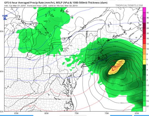
The coastal low moves off pretty quickly Saturday morning, making for a less soggy Saturday (via GFS).
Featured image courtesy of James Newport.