
Last night, president Wallace Loh presented the Maryland students with the wonderful news that school would be cancelled on Wednesday due to the snow storm crossing over campus. And good thing campus closed, since the snow was quite heavy in the early morning. Around 7 a.m. snow fell at about an inch an hour until around 10 a.m. (WTOP) calculated that College Park had around 3 inches of snow at 1 p.m. However, due to some warmer air aloft, the snow began its transition into sleet earlier this afternoon.
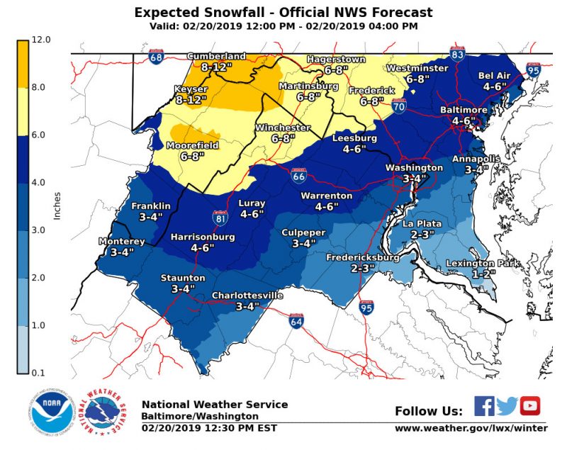
Expected Snow Totals courtesy of the National Weather Service
Tonight (Wednesday):
Late this afternoon surface temperatures will begin to rise to about 32 degrees, and with it the sleet will make another transition into freezing rain. As night falls temperatures will continue to rise slightly above freezing and the freezing rain will turn to rain. The nighttime rain should also melt much of the snow leaving little left over in the morning.
Tomorrow (Thursday):
Precipitation should be finished by sunrise, but expect some thick clouds to linger. As the day progresses the clouds will begin to part for some sunlight and some warmer temperatures in the high 40s. Additionally, wind speeds should be moderate to negligible in the low single digits.
Tomorrow Night:
A weak cold front is anticipated to cross over the DMV late Thursday night, bringing temperatures back into the norm in the low 40s. The front is not expected to bring any additional precipitation or significant winds to campus.
A Look Ahead:
Friday looks to be a typical winter day with temperatures in the 40s and a dreary cloudy day. Into the weekend, a slow moving warm front will bring more precipitation, but this time in the form of rain. It should rain throughout almost all of Saturday and carry into Sunday morning. Once the warm front has passed, temperatures will sharply rise up into the 60s.
Featured image courtesy of the author.