
Today was a standard February day, cold and partly cloudy. High temperatures barely scraped into the 40s and will drop overnight. However, high altitude clouds begin to move in at the beginning of the night, signaling the approaching snowstorm.
Tonight:
Temperatures drop below freezing overnight, falling into the upper-20s. Clouds continue to accumulate overnight as the storm approaches.
Tomorrow (Wednesday):
Tomorrow will be an exciting day of winter weather. Starting around 6 a.m., the snowfall will start falling at a quarter of an inch per hour and increase over the next few hours. In the late morning, snowfall rates will approach nearly an inch per hour.
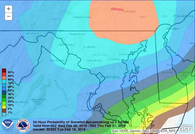
Washington DC is forecasted to have a 70% chance of getting at least 2 inches of snow tomorrow morning. (image from the Weather Prediction Center)
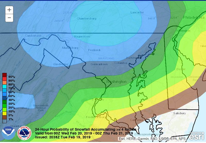
DC has a 40% chance of getting at least 4 inches of snow tomorrow morning. (Weather Prediction Center)
As temperatures fluctuate around freezing in the early afternoon, the snowfall will transition into a wintry mix, composed primarily of sleet. Cold ground temperatures could lead to ice forming, especially in the case of melted and re-frozen snow.
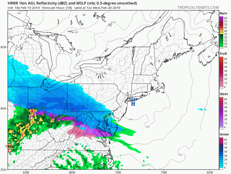
Snowfall in the early morning transitions to mixed precipitation in the early afternoon, which is then followed up by rain (HRRR model on Tropical Tidbits)
After a couple of hours of wintry mix, temperatures warm up enough to transition into rain. At this point, temperatures should be warm enough to start causing snow and ice to melt, but cold ground temperatures could leave some ice.
Tomorrow Night:
The warm sector continues to move in overnight, bringing with it more rain and higher temperatures. Overnight and daytime warming should cause considerable melting of ice and snow, mostly clearing up the effects of this storm for Thursday.